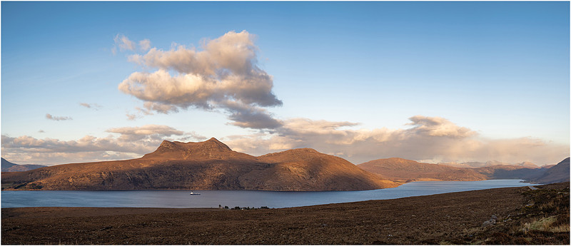
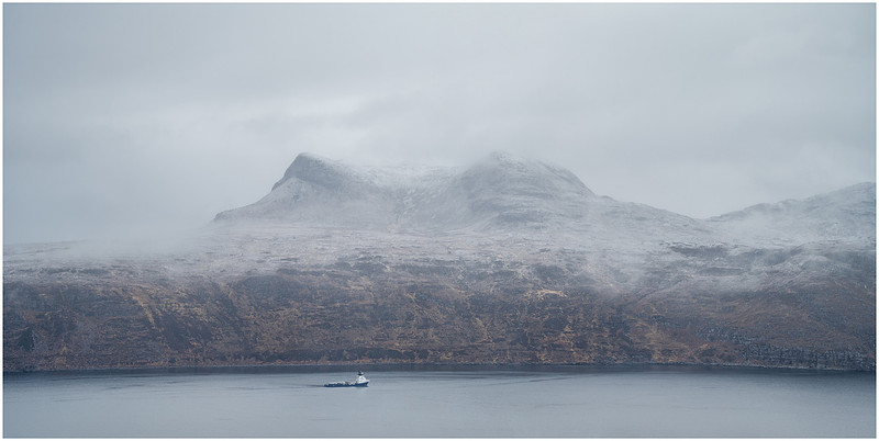
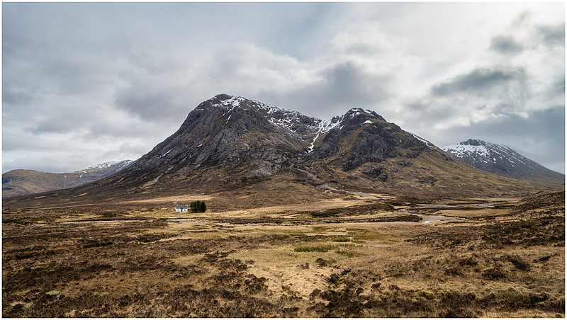
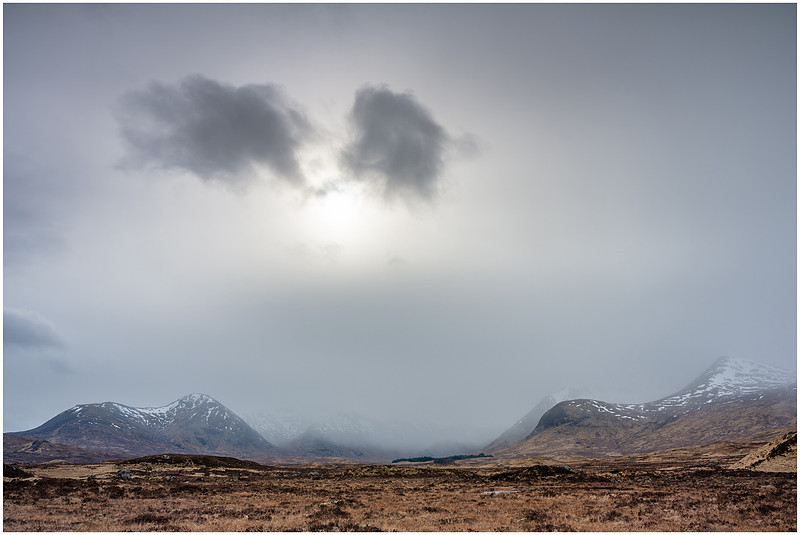
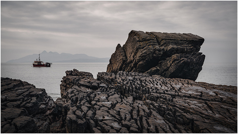
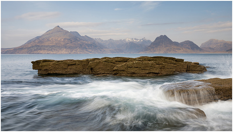
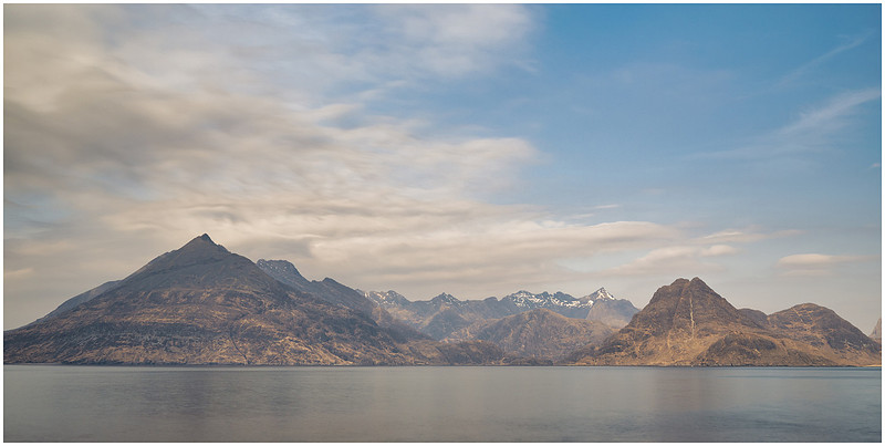
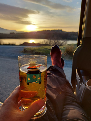
Autumn adventure in Scotland, UK. (Part II)My heart's in the Highlands, my heart is not here, my heart's in the Highlands, a-chasing the deer, chasing the wild-deer, and following the roe, my heart's in the Highlands, wherever I go (My Heart's In The Highlands - Robert Burns).
Drive north along the shores of Loch Lomond you pass through the village of Tyndrum, where you are greeted with a promise of great food and a last chance to fill your petrol tanks before you truly enter the Scottish Highlands. Stretching from Oban on the west coast up through the Isle of Skye, along the coast traversing the Torridon Hills, the Assynt Mountains and on to Durness. Reaching as far as John o’ Groats and hemmed in by Loch Ness. This is the Scottish Highlands, a magical place that has been in my heart for many years.
- - - - - -
I was on Day Five of an autumnal adventure to Scotland, and so far had skirted along the east coast, visiting Rattray Head and Portknockie before turning inland and spending the last few days at Loch Garten in the Cairngorms. Now, my course was set to head northwest via Ullapool deep into the Scottish Highlands and on to Assynt. The Assynt Mountains have appeared on my itinerary during a number of previous trips around Scotland, but for various reasons (usually weather) they have been skipped during some replanning. Well, this time the tables were turned and they were added into an itinerary over a cup of coffee, cheese toasty and a weather forecast. Very excited! Chase the light! Chase the cheese!
Important executive planning session
After a couple of nights in the Abernethy Forest at Loch Garten, a trip into nearby Aviemore was on the cards to “freshen up” and get a proper cooked meal or two. Whilst sat in Costa, I had my maps, weather forecasts and sat nav out. I truly had not decided where to go next. Staring at my map of the Highlands, there was “Assynt” shouting out at me, that place I had skipped so many times when beaten back by the weather. A hop, skip and a jump through Inverness and I would be on the A835 heading to Ullapool before you could say £1.99 a litre. With a trip to New Zealand early next year and most of summer for 2023 already booked, it was going to be at least a year before I could get back this far north for more than a few days. Before I set off, I had to pay a quick visit to the outdoor clothing shop at the end of the car park that had a 25% off everything sale on. Gotta love a bargain. Within an hour I was trundling along more tree lined A-roads bathed in autumnal sunshine. You can feel the climb out of Inverness as you skate around lochs and valleys. A brief “Max-stop” at Silverbridge and Black Water Falls.
Black Water falls
The weather was great when I started off but the closer I got to Ullapool, the more the light deteriorated and the more the wind picked up. This is quite familiar territory in the Scottish Highlands, but it can change in the blink of an eye. Keep going boy, don’t let it put you off! After passing through Ullapool and grabbing a few vital supplies of dog biscuits, beer and cake, I headed out of the port and climbed uphill towards Strathcanaird to find my first view of the Assynt range.
Stopped on the A835 at Strathcanaird
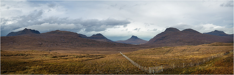
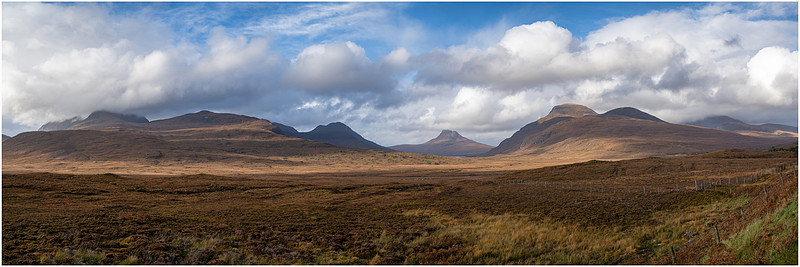
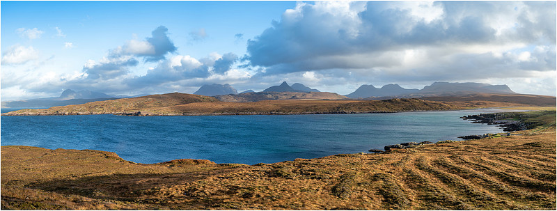
There is one mountain in particular that has fascinated me for some time because of its shape and geology, and that is Stac Pollaidh or “Stac-Polly” as it is affectionately known. Formed from Torridonian sandstone, the peak was left exposed during the last ice age (A nunatak). As the ice sheet flowed to the coast it carved the lower slopes leaving them smooth whilst the top had been left exposed to weathering leaving the rocky crest. Stac Pollaidh has a sister “nunatak” Suilven, that I would be passing later on that day. For now, I wanted to capture a panoramic view of the mountains. The weather and light was rubbish, but I knew I would be back along this way in a few days, so I considered this a practice and would pray for better weather on my return. This smaller part of Assynt beyond the line of these mountains is known as Inverpolly with a narrow single-track road leading to the Coigach peninsula and Summer Isles.
The Assynt Range and Inverpolly beyond
From left to right: Ben Mor Coigach, Beinn an Eoin, Stac Pollaidh standing proud in the distance and Cùl Beag to the right. The only bit of light to appear, managed to catch this fence in front of me. I made a note to move more to the left when I return. According to the information board at this amazing viewpoint:
“Picture the scene here 25,000 years ago… All you would have seen was a great expanse of ice covering even the highest mountains and flowing far out to the west, beyond the Isle of Lewis.”
Bonkers! That is some ice sheet, as you can see from the map below where I have pinned where I was stood with the islands of Lewis and Harris out to the West.
One more shot before I must move on.
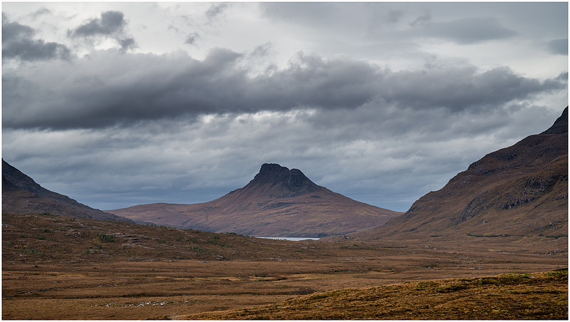
Stac Pollaidh
Below Stac Pollaidh you can just make out Loch Lurgainn, and it is here I would be travelling the next day. But in the meantime, I was to continue my journey up the A835 and on to Loch Assynt.
I can’t really mention the A835 without also talking about the North Coast or NC500. Glorified by Jeremy Clarkson and his motley crew from Top Gear, the route around the north coast of Scotland has turned into a slow procession of over-priced sports cars clogging up the single-track roads and filling stations. I can only imagine the impact upon local traffic as processions of vehicles drive too close together for the passing bay system to work at all. After all, they are designed for infrequent single vehicles to be able to pass each other, not a line of 20 odd Ferraris meeting a tractor coming the other way. Controversial, as I’m sure the route also brings tourist money to the area, but how much is actually kept by those who live there must be questionable. Thankfully the majority of users of the NC500 following in Clarkeson’s footsteps bouncing their expensive Lamborghinis through the potholes and ditches only visit in summer when I stay well clear.
Grabbing a snap of Suilven
Why is there a 'Junction outside a bend' hazard sign in the middle of the field?
Not long after passing through Elphin and grabbing a roadside snap of Suilven, the weather really took a turn for the worse and it was just a case of getting to my overnight stop at Loch Assynt before it got dark. The heavens opened and it rained and blew for most of the night meaning a rocky night in the van at my rather exposed parking spot. Was I once again going to be blown off track visiting Assynt?
Day 6
That pre-dawn alarm rattled through the van signally to Max its jump on the bed time. Thankfully the rain had almost stopped with just an annoying drizzle to dampen our spirits as I fished Max’s breakfast out of the boot. I had somehow managed to forget Max’s food bowl when I set off from home, so had been feeding him from a paper bowl during this trip. I had just about managed to get my timing right by day six putting his food box back in the van just in time to grab the paper bowl before it blew away. He eats like it’s his last meal. Today my timing was out, and I ended up running through the mud in my PJ’s and sliders as the bowl disappeared down the bank towards the loch.
A slightly damp view from my bedroom
A quick cup of tea and breakfast muffin for me before jumping out of the van and getting stuck into another day of Photography in the Highlands. Not in my PJ’s I might add. I had come to this spot on Loch Assynt specifically to photograph the small islands, and had been hoping for some mist. Unfortunately, all I had right now was light drizzle and very grey skies. Even at sunrise, the light did not change, so thick was the cloud cover. The forecast was for an improvement, so Max and I spent an hour wandering the shoreline navigating boggy holes, rocky outcrops and boot sucking peat mud. Glad I had my wellies on. Max just got wet and muddy (again). This trip was the first full test of Max’s drying coat in the van. He is a big Labrador and mud just seems to find him and stick. No matter how much you try and dry him off, he will wait until he is back in the van and shake sending thousands of muddy droplets of water spraying on the roof, the seats, the windows… everywhere!! Now I am armed with a drying jacket, which is basically a towel that goes over his head, wraps around his body by Velcro and hooks over his back legs. We call it his “smoking Jacket”. I’m sure the manufacturer ruffandtumblecoats.com won’t mind me using their stock photo as Max will not keep still long enough and hates the camera pointing at him.
Ruffandtumblecoats.com
I can’t recommend these coats enough. First of all, it stops that dreaded “van shake” and within a very short time Max is bone dry. Strangely, so is the coat. I can only assume his body heat pushes the moisture out and it evaporates straight off the jacket. Either way, I don’t find myself needing to dry the coat. It’s magic! Anyways, back to the first photo of the day.
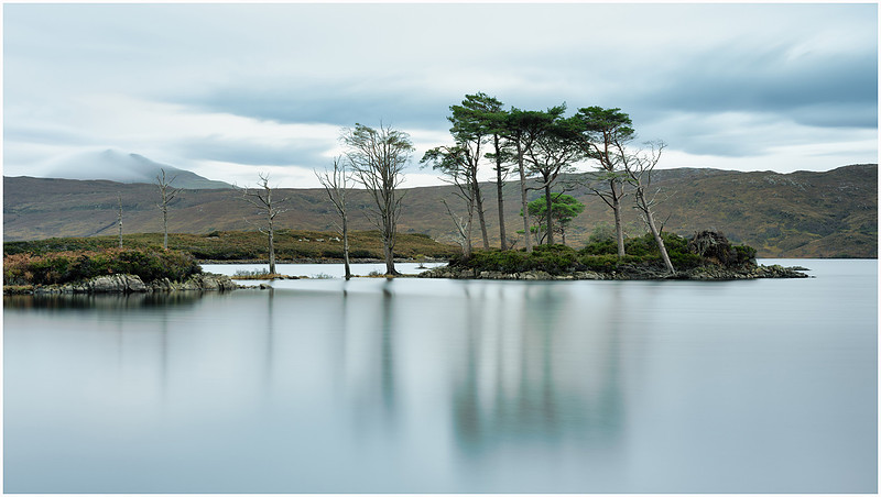
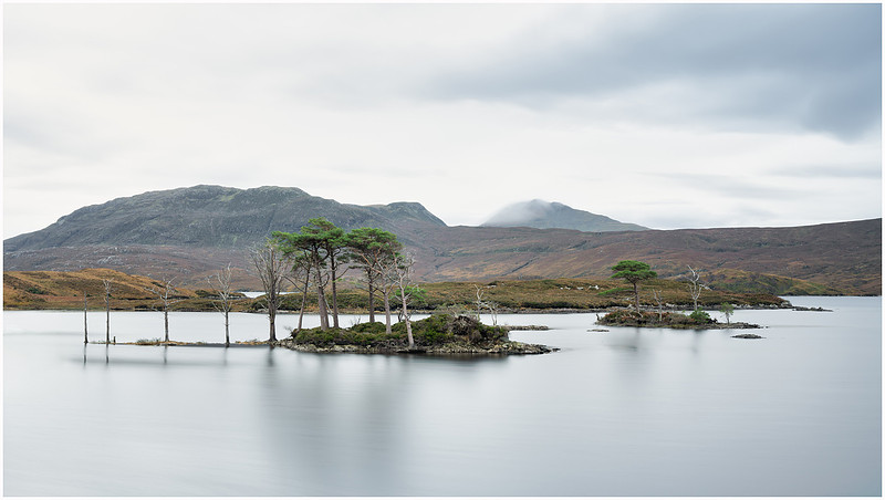
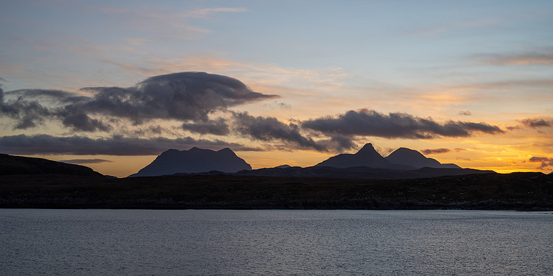
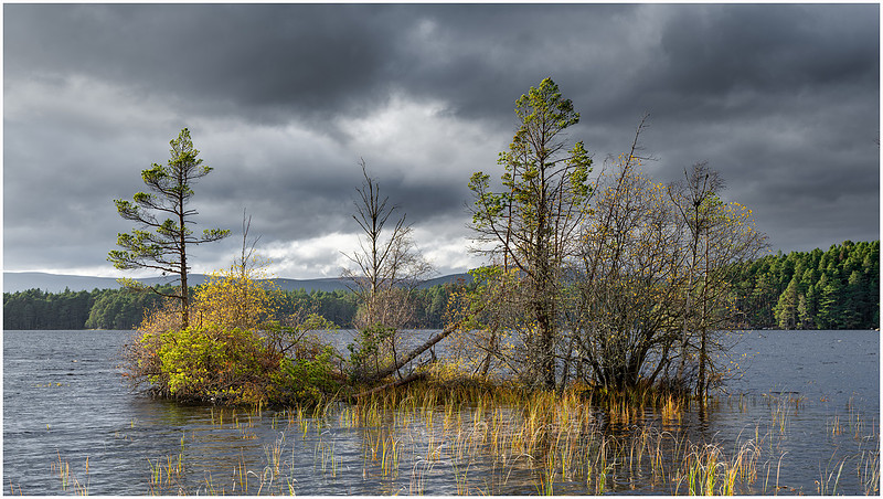
Loch Assynt islands and Canisp shrouded in cloud
With the drab weather and lack of direct light, I decided to go for a long exposure to remove as much distraction as possible and focus on the islands. I dropped in my 6 stop NDF filter, polariser maximising the reflections and set the timer at 240 seconds at f/11. I’d normally need my 10 stop NDF, but as it was still 07:45am on 1st November, it was still dark enough without it to get this long exposure. Whilst a nice shot, I wasn’t happy with the composition. I was struggling to isolate the islands at water level so decided to climb back up the embankment to get a higher viewpoint. In my minds eye when I planned to visit here, I had mist on the water, early morning sunlight, maybe majestic white swans paddling by. Ok maybe not the swans, but I was struggling here in such flat light. My second image was only marginally better.
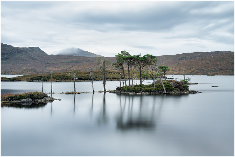
From a higher viewpoint
This was better, but the smaller island in the background was merging with the nearer and the tops of the trees were interfering with the skyline. I liked the line of trees to the left of the main island but wanted some separation.
Separation, it’s all about separation.
I’m no higher here. I have just moved over to the right. What this has done is isolate the far island from the near and also separated the 4 trees from the tiny island that was on the left. Also, just the move to the right has moved the highest tree tops in front of the hill behind rather than breaking the skyline as in the previous shot. If you are going to breach a skyline with your subject its needs to be bold. Finally, the cloud covered Canisp is now in-between the islands and the composition feels more balanced. So, three different compositions of the same view. Which do you prefer? Not the conditions I would have preferred, but it has served as a good example of how moving around a location can change the composition significantly, and getting separation and balance is key. All I needed was a little mist between the islands and the far shore and this would have been pretty much perfect. I suppose that means I need to come back. There was only one other way I was going to improve the composition from this angle and that was to employ a drone. But I really don’t like drones. I’ll come back to my dislike of drones another day, but it involves ‘more money than sense’, ‘sitting in the comfort of your car in a nice car park’, ‘not getting wet’, ’no effort required’. If paying my mortgage depended upon my photography, I’d likely employ a drone as a secondary piece of equipment, but as it doesn’t, I won’t. I’d spotted a group of rocks further down the shoreline, but they looked quite tricky to get to, involving wading through part of the loch. I dropped Max back at the van (in his smoking jacket) and discarded my pack just carrying the setup I was using. I managed not to fall in, get my feet stuck or drop anything in the loch as I wobbled through the water nearing the top of my wellies. Once I had made my way over to the rocks my luck changed, as did the temperature of my feet.
What’s that reflecting in my camera screen?
It was a faint glow I noticed at first, but things were brightening up behind me. This composition was ok, with the 3 rocks giving some foreground interest, but as you can see from the phone shot above, the flat light was giving no contrast or depth to the image. Another great shot with some mist or an amazing sunset behind, but not as it was. Thankfully what was appearing behind me did materialise as direct light for a mere 15 minutes, so I snapped away.
Morning light
As the rocks were very close to the camera, I decided to set my aperture at f/11 to give me a reasonable depth of field to get both rocks and trees in focus. To do this I used the hyperfocal distance method to place my focus. The theory of Hyperfocal Distance is well explained on a number of google searches, but in short, by placing your focus at a certain distance from your camera, depending upon the aperture and focal length, you can guarantee everything will be in focus from halfway to the focus point all the way to infinity. Using the Hyperfocal table in Photopills, my aperture of 24mm at f/11 has a hyperfocal distance of 1.72 metres or 5 ft 7 inches in old money. This would give me focus from half that distance 0.86 metres all the way out to infinity or in this example the trees and the hills beyond. This is best explained accompanied by a visual representation.
Having looked this up on the table, I estimated what part of the rocks was about 1.7 metres away and focused the camera on that point. Is this the best method? Well, I have had mixed results and given an option I would normally go for focus stacking, taking several shots at different focus points from near to infinity that can be stacked and blended. However, when things are moving or there could be changes in light between shots this method can be quite difficult to execute. If you look at the image captured, the reflection of the trees in the water extended right up to the rocks, and given I was using a 2.5 second exposure, chances are each shot (probably 3) would have a different reflection in the water as the breeze changed the surface of the water making the blend challenging. No need for a graduated filter or bracketing here as the tress were lit from behind me and no risk of a silhouette. I wouldn’t say Loch Assynt was disappointing, but clearly this location needs mist or better light to be appreciated, so now I have some compositions, I just need to come back another time for the light. Maybe Ardvreck Castle further down the loch would give me something special. A short drive down the loch and I parked up Mr T in the layby. My time was limited at this location, so after a few test shots and a wander, I opted for keeping the castle aways a little and bringing in the peak of Spidean Coinich in the background.
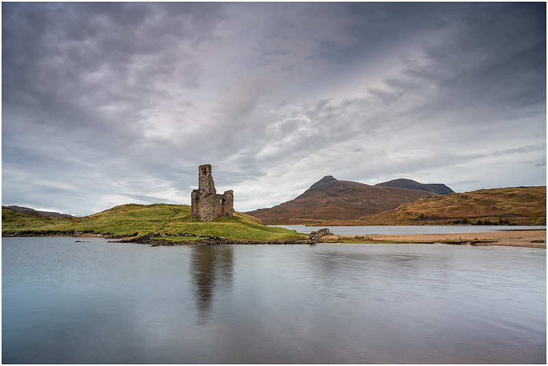
Ardvreck Castle
Spidean Coinich is the tail of the Y-shaped Quinag whose highest peak Sail Gharbh you can see beyond the first peak in this image. In my first image I wanted to keep the detail in the clouds as they fanned out from the top of castle. They were creating fantastic leading lines and definition in the sky. To do this I kept the shutter speed at a relatively quickly half a second at f/11. The sky was actually quite bright at this time, so I dropped in a graduated filter to bring the sky down a little and not blow out the highlights. From memory this was a 6 stop grad medium filter so as not to interfere with the castle or mountains. A nicely balanced composition complimented by the great cloud formations, but if only that sun would come back out again and light up the castle.
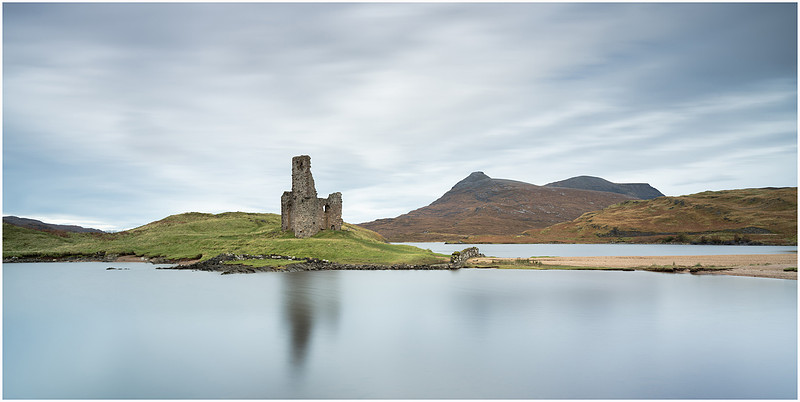
Longer Exposure
Whilst I waited for the chance of the sun emerging once again, I dropped in my 6 stop NDF and pushed the exposure out to 60 seconds for a different perspective of the same view. Unfortunately, the sun did not reappear, so I jump across the road and grabbed a few shots of the waterfall right next to the van. Two for the price of one at this location.
Ardvreck Castle Waterfall
Time to move on and my next stop was to be Knockan Crag 20 minutes away. In the time it took to drive to the location, day turned to night and the heavens opened once again.
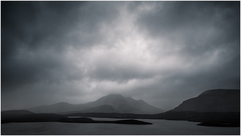
Lochan an Ais and Cùl Beag take a direct hit
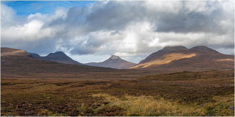
Man, it rained so hard, I climbed between the seats to get in the back of the van and put the kettle on to avoid a right soaking. This cloudburst battered the van in the car park for over an hour, so I had some breakfast and double checked my route for the rest of the day. I intended to travel down the narrow roads to Brae of Achnhaird so needed to be sure of my route and timings so I didn’t miss the light. The downpour seemed to be the back end of the miserable weather and the sun quickly came out. But, I had to make the decision to skip this location as I wanted to return to the Strathcanaird viewpoint and get that panorama with better light.
Stac Pollaidh beckons
I was so glad I returned to this location and grabbed this shot. The light was perfect, and the post downpour clouds made for a great sky. This image was taken using my usual 50mm prime lens multiple shots technique and stitched together in Lightroom. As planned, I had moved about 20 metres to the left today, which reduced the impact of the fence line in the foreground. I took a quick phone snap of the little map at the viewpoint.
Inverpolly
Just one more photo from this viewpoint of Stac Pollaidh before I jumped back into the van and made my way down the winding road through this very valley.
Stac Pollaidh
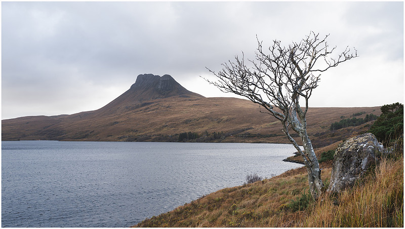
As I was bumbling along the narrow road, eyes on stalks looking out for oncoming vehicles and the next passing place, I spotted a tree sticking out from the side of the bank and dived into an “extended” passing place. Clearly, I wasn’t the first person to stop here, but didn’t want to push my luck so I moved quickly, scampering down the embankment to get the tree framing the loch and Stac Pollaidh. No time for waiting for the light here, so “wham bam” I grabbed the shot and legged it back up to the van. Nothing to see here! No Englishman plonking his van in a passing place at all. Never happened! This wasn’t to be the last time I was running today.
Not a shot from a passing place
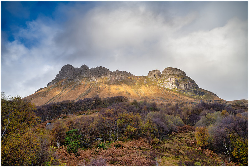
Not a great shot, and no time to wait for the sun to come back again, so I thought maybe I could try again tomorrow on the way back. I was in for better luck as I got to the bottom of Stac Pollaidh and took a little more time to get this next image of the sun reflecting off the crags and great autumn colours near the road.
Autumn colours of Stac Pollaidh
I’ve read plenty of accounts and seen many images of climbs up Stac Polly, so fully intend planning a return visit without Max at some point. The view would be amazing from up there! The rest of the way to Achnahaird, the road got narrower but more scenic and soon enough mountains were replaced with sand and sea and after a sharp right down a farm track, I landed at my overnight stop. I’ve rocked up at some great overnight parking spots before now, but this one was surely pretty near the top. I think the fact the sun had come out did help, but I had a fat grin on my face.
No 1 camping spot
I’m not one for getting too over excited, honestly, but right now I was a kid in a sweet shop. That view! The location! Them mountains!
Do I go left, or do I go right? Up? Down?
Tick tock, time was ticking away until sunset.
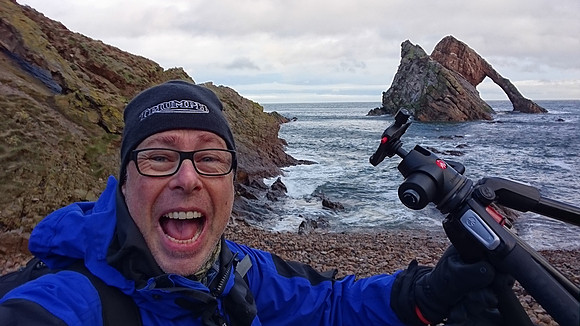
To my left was a medium sized hill that looked like it would command a great view, so I was off. Parka on (don’t let the sunshine fool you, it was freezing), full pack (who knew what lens I would need) and Max. We started at a reasonable marching pace, but it wasn’t long before I found myself running up that hill (queue Kate Bush) desperately hanging on to Max on his lead who was showing me the way. It was an almost exact repeat of Bow Fiddle Rock 2019, except this time I wasn’t running downhill, which I think may have lessened the effect. It’s not the initial impact of knees and hands into the soft muddy peat that shocks you, it’s the full backpack in the neck as you come to an abrupt stop. Imagine slamming the brakes on in your car with an unrestrained 40-pound St Bernard on the back seat. I don’t think anyone saw me, but my gloves were now rendered useless soaked in brown peaty water and I’d ruined a brand new pair of pants in the process. The ones I had bought yesterday in that 25% off sale in Aviemore for goodness sake. Dooooh. Onwards! Thankfully the view from the top was great so I set about one of my skinny panoramas.
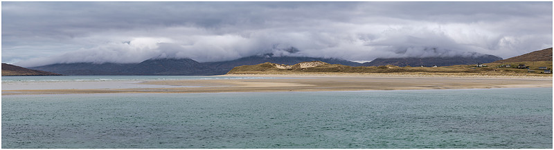
Achnahaird Bay
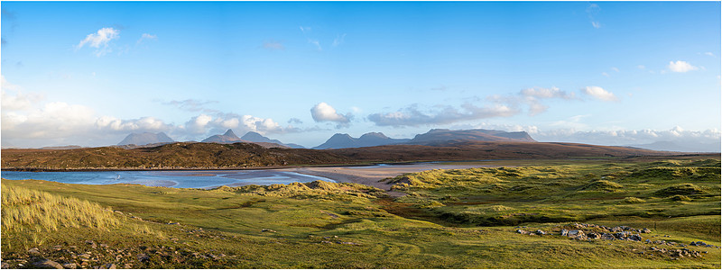
The low light was highlighting the lines of raised ground creating perfect leading lines down to the shore. These are man-made, and left over from the farming methods of the early crofters. I have seen the same at the foot of Quiraing on Skye and dotted around Lewis and Harris. According to the Soil Survey Of Scotland, I believe it is known as the “lazy-bed system, whereby peat cut from parallel furrows is spread over the intervening rigs and mixed with shelly sand and seaweed to form a better rooting medium”. Mainly used for potatoes. Something wasn’t quite right with this image though. I could see a lovely sandy beach in the distance, but it was too far from me, and the bay was slicing the image in two. I think as the tide was in, there was not much beach in view, so it more resembled a loch than the coast. It’s a great record of what I was seeing, and if you look closely you can see Mr T parked up in the bottom right corner. But it wasn’t the image I came here for. After pondering for a while I decided to abandon this spot, head back down off the hill and walk along the shore towards the beach I could see. It was here I found what I was looking for (Now I can here Bono). A nice beach, the sea filled less of the image (being up high isn’t always necessarily best) and a very obliging lady and her two dogs took a walk across the sand bank just as the sun was setting behind me giving the image a sense of scale.
Achnahaird Beach
Left to right Suilven, Cul Mor,Stac Pollaidh, Cul Beag, Beinn an Eoin and Ben Mor Coigach. What an amazing place. I can’t begin to describe the scale of the view and how I felt “on the edge of the world” out here on the coast. One road in and one road out to a small number of houses. What a great place to live. I was much happier with this image so headed back to the van to get that kettle on, warm up and get my soaking wet pants and gloves dry.
What a good sunset feels like
It was a lovely quiet night down on the shoreline and I spent the evening editing images as I knew I was going to have a lazy morning before heading off mid afternoon. Yes! A lie in!
The view from the van just before sunrise
I briefly woke to check out the sunrise and grab a snap from the van, before going back to sleep for a well-earned lie in. Weather changes quickly out this way and whilst having breakfast, a weather warning came in for gale force winds and heavy rain which was hilarious given I had just enjoyed a cracking sunrise. But, the wind was soon picking up so I decided to head off before lunch and start to make my way south through the Highlands. I didn’t really have much of a plan, more a desire to visit a few places on the route home. I decided to head for Inverness and follow the route down Loch Ness as this would give the most miles for my buck. The weather quickly turned as I followed the A82 towards Strone.
Dark clouds looming
In short, the weather deteriorated very quickly as I trundled down the A82 so much so driving was becoming quite tricky, so I opted to pull in at Fort Augustus and park up in the community campervan park for the night. 24 hours were lost sheltering from this one. I won’t go on about it, you know the routine: howling winds, rocking van, wet dog and a few beers from the fridge. Later the next day I eventually pulled into the layby on the road to Glen Etive and found a good parking spot for the night.
Another great parking spot
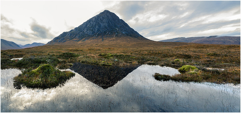
It was around 1pm and it looked like the rain was coming to an end, so I headed out in a light shower to the waterfalls at the base of Buachaille Etive Mòr. This is a VERY popular spot for photographers, but I could see there were no other vehicles and I had the spot to myself in the rain. It’s a tricky location to negotiate and the view of the mountain is obscured by a number of trees limiting the compositions. Such is the volume of visitors, its an absolute mud bath on the banks of the river overlooking the waterfalls. I found a good view right on the edge of the bank and grabbed my first image whist it was still raining.
The last of the rainfall
The rain was starting to clear with the breaking sun reflecting off the wet rocks of Buachaille Etive Mòr in the background and a few shafts of sunlight starting to break through to me at the river. I moved around a little and found another composition that involved me kneeling down in the only dry spot with one of my tripod legs hanging over the edge and sitting on a rock above the river. There is a lot to capture here so I was using my wide-angle lens way out at 16mm. As the light began to move closer, the sky became brighter and I opted to bracket the image to avoid losing the detail in the sky. I couldn’t user a graduated filter here as the top of the mountain and tree would appear darker and look odd. The dynamic range of the Nikon Z7 and bracketing should allow me to bring this out in post-production. My first image as the rain was clearing was all about the mood and keeping my camera lens dry, so I chose to just about freeze frame the water by setting my exposure at 160th second at f/11. For this second image I wanted to take my time and get some movement in the water, so moved my exposure out a little at a time until I had the desired effect. Not long streaks you would associate with ½ second more just some motion blur. I settled on 1/30th second giving me what I was looking for and then adjusted my aperture to f/16 to give me the right exposure as the light changed.
I was happy with this image and set about flipping my camera to landscape to grab a second shot, when I heard lots of voices behind me. Within seconds I was surrounded by a large party of German photographers. Literally, seven people tried to crowd around me as I was kneeling on the floor. I swear at one point this chap behind me rested his camera on my head.
You’re surrounded, come out with your hands up!
The grimacing lady to my right was getting quite frustrated and whacked my tripod a few times before I had to ask her to back off. I don’t speak German, but I can guess what was being said. I had taken my second shot and checked all was ok, but was I moving? Was I pump! I took a few selfies, checked some imagined second shot a few times giggling to myself before I finally, slowly stood up and took my time putting my camera in my bag and folding my tripod. I’d have been more convivial if it hadn’t been for the tripod bashing.
My German friends
Where the furthest left man is standing you can see the only dry spot where I was kneeling. I suppose it is to be expected when visiting such a honeypot. I wandered upstream a little standing next to the riverbank giving them something to remove in photoshop when they got back home before saying Auf Wiedersehen as I crossed over the river and headed towards the small bogs higher up, still in shot. I’m so naughty!
Reflections of Buachaille Etive Mòr
The light had come and gone in a brief 30 minutes, during which time I had grabbed some great shots, been nearly pushed in the river by my German friends and placed myself right in shot on the other side of the river for good measure. "Verrückter englischer eindringling". My time in Scotland was running out and despite many prayers, there was not going to be any magical sunset where I was, so it was a case of enjoying the location and getting an early night before the long haul home in the morning.
I had finally managed to visit the Assynt range, and although the weather had been changeable, I found some great locations and compositions that I can come back to at any time when I am nearby. The beach camp at Achnahaird had been the highlight of this second part of my Autumnal adventure in Scotland and I will definitely be back to explore further. A chap who also stayed over recommended Achmelvich Bay up past Lochinver and was in his opinion the best beach on the whole west coast of Scotland. Now that needs to be verified at some point. Breakfast at my favourite café (therealfoodcafe.com) fueled me for the 260 mile drive home for a shower and a proper hot meal.
Thank you for reading this far, and I hope you enjoyed the trip. Autumn adventure in Scotland, UK. (Part I)Into the coppery halls of beech and intricate oak to be close to the trees as they whisper together let fall their leaves, and we die for the winter (Whim Wood - Katherine Towers). The trample of robins and woodlarks on the brown leaves. and the patter of squirrels on the green moss, The fall of an acorn on the ground, the pattering of nuts on the hazel branches as they fall from ripeness (Pleasant Sounds - John Clare).
Autumn, my most favourite time of year, when I wait each morning to see how the colours have changed and if the mists have formed. When Max and I, torch in hand, now make the morning walk briskly kicking leaves trying to avoid a daily soaking. With both fine weather and storms forecast, the time had come for my annual autumn trip, and this year I was blessed with another visit to Scotland. I had a planned itinerary, but with the freedom of flexible time, I knew it could be easily changed or dumped as and when the weather came through. According to the forecast I could expect just about everything, so we packed up the van with all the right clothing, footwear and towels for Max and hit the road.
Ready for the off (all important bone)
As a warm up, and also to break up the long journey to Scotland’s north east coast, we headed straight for Bamburgh Castle. I have a favourite spot where we stop for a few hours rest, right on the beach. So, Day 1 would be all about driving and getting closer to Scotland. Bamburgh beach is one of my favourites, with long flat sands, glorious sunrises and a great atmosphere when stormy. I took one of my favourite pictures there last year.
Stormy Bamburgh
The forecast tomorrow was for a brief dry window just before sunrise, but as ever it can be very changeable on the north east coast of England and I wasn’t expecting it to last for long before the front came over. So, I enjoyed a relaxing evening all toasty in the van with a book, listening to the waves crash below me on the beach before setting my alarm for nice and early. I’m currently reading the DI Nick Dixon Crime Series if anyone is interested. Highly recommended.
Day 2
“I eagerly bounced my ample backside over the lumps and bumps “
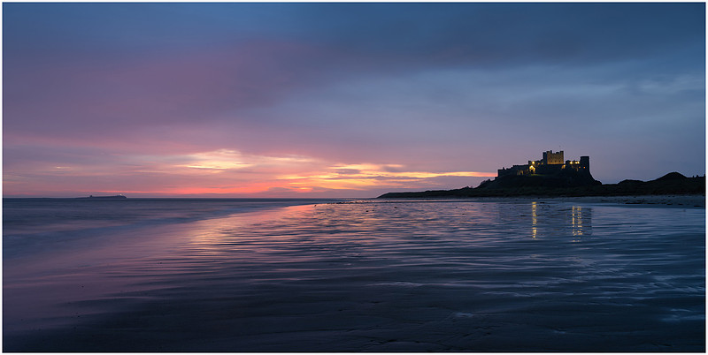
The morning came and Max and I headed out for a walk along the beach after having something to eat. It was still headtorch time, but Max managed to have a good run as the tide began to turn, finding a few decent washed up logs to chew on. As forecast, just minutes before sunrise the heavens opened and chased us back off the beach and into the safety of the dry van. But not before I had planted myself on the shore and grabbed one image. I used my wide-angle lens to include the lighthouse on the Inner Farne Islands. Something I normally exclude here, but given it was still dark, the flash from the lighthouse added an additional element to the picture.
Before light at Bamburgh Castle
Nothing complex here for this shot, apart from keeping the tripod just above the point where the waves were washing in. 24mm focal length, aperture at f/8 and a 6 second exposure. I did pop the ISO up a little to 100 as it was so dark. Dried off, my next location was to be Canty Bay, north of Dunbar on the way up to Edinburgh. But after an hour on the road, it was clear this heavy rain was set in for the day and getting heavier. Breakfast in the services, and I poured over the maps and weather forecasts and opted to spend the wet day driving and keep heading north another 230 miles further to a familiar location at Rattray Head. The forecast for the next morning was looking good and there was a great isolated spot next to the beach where I could camp out for 24 hours. After all, as much I do like sunrise to sunset photography, chilling out on location is also a must and something I always add into my itinerary where possible. Those of you familiar with some of my previous trips will know Rattray Head is where I lost a very expensive lens to the elements during a brutal storm a few years ago. Gale force winds, horizontal airborne sand and cameras don’t always mix well. I did manage a few images in that visit but the damage to the lens rendered them average at best.
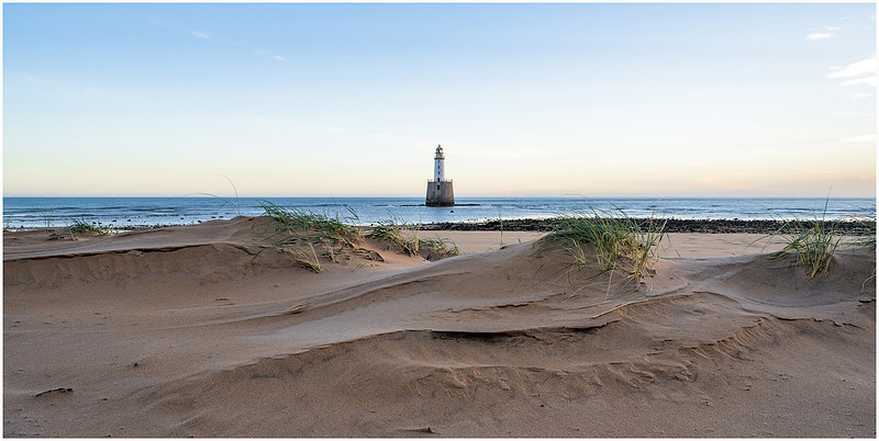
Rattray Head 2019
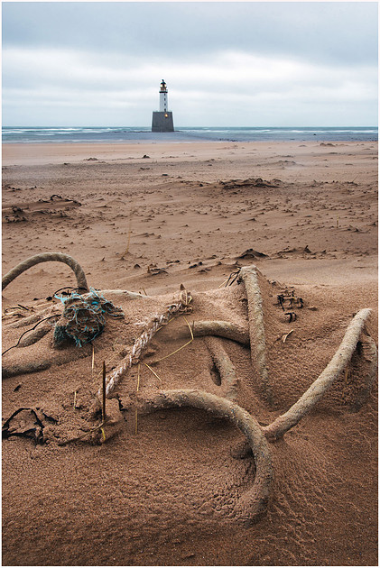
A lump of washed up rope and shaky blurry lighthouse is not what I came all this way for. I wanted to try again. - - - - - - - - The road to Rattray Head is a long, narrow affair once you leave the main roads. You need to take your time dodging van-swallowing potholes and ditches praying nothing is coming the other way as there are no passing places, just a very long reverse for the unlucky party. It was becoming clear I was in for a great sunset despite the gloomy forecast, so I eagerly bounced my ample backside over the lumps and bumps. After 200+ miles of travelling, Max was busting to get out and “stretch his legs”, so as soon as we got to the small car park he was released and made straight for the sand and a swim.
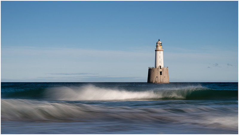
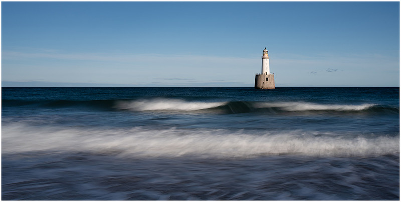
The beach at Rattray Head juts out into the North Sea and catches the prevailing winds coming in from the sea. This means high sand dunes, an ever-changing landscape and plenty of washed-up debris. Its location at the end of a tricky narrow road means you are likely to be the only person there for most of your visit, as was the case for me again. After Max had his swim and dived around the sand dunes to dry off, it was time to get down to business as the sun began to sink behind me. I had arrived at high tide so was excited to get some great shots of waves crashing on the beach with the lighthouse in the background. What would I find washed up on the beach? I wanted to slow down things a little and capture some movement in the waves, so dropped in my 3 stop NDF filter over the top of my polariser. With the afternoon light, this allowed a 1 second exposure at f/11, perfect to show movement in the waves and keep most of the image in focus.
Standing room only
The lighthouse is just away from the beach, so is a popular spot for cormorants to sit and dry off their feathers after a fishing trip. I dropped my tripod down lower and zoomed out a little to capture some of the wash coming up the beach.
Incoming wash
The whole time I was taking these shots we were eagerly watched by a seal offshore. A head would pop up for a few seconds, have a good look and then disappear. Max didn’t notice, even when he went in for a swim. According to the Northern Lighthouse Board:
“Rattray Head lighthouse was built in 1895 and engineered by David Alan Stevenson. Work began in 1892, and the masonry of both portions of the tower was completed in 16 months, spread over three seasons. The lower section, 20,000 cubic feet of dressed granite blocks mostly quarried at Rubislaw, was 46 feet high, with an entrance door reached by a 32 foot outside ladder, at high water it is covered to a depth of 7 feet but it is possible to walk ashore when the tide is out, the upper, with a case diameter of 21 feet for the lightroom, lantern and dome brings it to a total height of 120 feet above the rock. During the Second World War on 20 September 1941, an enemy plane circled the lighthouse and dropped three bombs, one of which did not explode. The lantern was machine-gunned but the damaged caused did not seriously impair the efficiency of the apparatus. No one was injured in the attack.”
Because of Rattray’s location on the east coast and the height of the sand dunes on the beach, it isn’t ideal for a sunset shoot as the lighthouse is cast in shadow well before the sun sets. That said, with the right cloud formation, some great sunset colour is possible. Today however, the clouds had all but cleared off, so I set about trying to get a reflection in the wet sand as the tide was retreating. Just after 3pm the sun was now low enough to be reflected in the windows of the lighthouse and the harsh bright light had been replaced with a soft pink across the whitewashed walls of the lighthouse.
Sunset pinks
Slightly longer exposure of 2 seconds here to capture the withdrawing waves on the sand and aperture at f/11 to stretch the depth of field. Definitely a bonus afternoon, as I had expected it to be still raining until darkness. Time to get comfy for the night and put some tea on. The sun was set to rise again at 07:20 and the forecast was still looking great. The tide would be at its lowest during sunrise, so the scene was going to be very different from this afternoon and I could look to see what had been washed up overnight. Classic hippy behaviour.
Day 3
The rattling alarm in the van, Max bouncing up on the end of the bed and me trying to find my glasses would become a daily routine, and this morning was a reminder of what these autumn sunrise to sunset days away are like. Of course, I wouldn’t change a thing because there is nothing better than putting the kettle on, opening the blind and seeing what your morning view is like. All without even getting out of my warm bed. My view this morning was the outline of the sand dunes and a faint warm orange glow in the distance broken intermittently by the flash of the lighthouse. I had positioned my van so that I could still see the lighthouse and had enjoyed its comforting regular flash of light during a very dark night. We hit the beach 30 minutes before sunrise, and I was amazed to see all my footprints from yesterday had either been erased or blurred out by the moving sands blown across the beach. I whipped out my phone and grabbed a few shots before heading off to the shoreline.
The tide had turned, and was on its way back in leaving very squishy sand and lots of nice pools, so Max and I wandered around looking for some foreground composition. Of course, doing this with a Labrador who likes nothing more than an empty beach to run around and search for anything edible, will always be a challenge. Most dogs, as soon as you let them off the lead on a beach they run around like a crazy wild horse and Max is no different apart from he instinctively knows where the best compositions are and runs through them leaving his mark before you can so much as take your lens cap off.
Fresh paw prints in my shot
Despite Max’s best efforts to trash my composition, I managed to keep this one clear long enough for the sun to rise.
Sunrise reflections in the pools
I waited patiently for this little cloud to move along and be reflected in the pool, whilst keeping Max sat still behind me.
Why the long face? Seaweed selection
Both these images are three-shot, bracketed, focus-stacked images.
The same result can be obtained by closing down the aperture to give a greater depth of field and dropping in a graduated filter for the sky. However, in this particular composition the lighthouse is sitting on the horizon so a graduated filter would have presented some challenges. Choose either method dependent upon your composition and the light. Read on and you will see the alternative method deployed in a rapidly changing scene. The sun was struggling to get through a bank of cloud on the horizon, so whilst I was getting a great sunrise glow, there was very little direct light on the lighthouse. Max had been wandering off earlier and found a bunch of washed up logs and sticks he could chew and nearby I could see what looked like a tree stump, so headed over to investigate. Keeping Max in check and doing a wide sweep to avoid my own footprints polluting the scene, I found a lovely grained washed-up tree stump. The sun obliged and came out washing the bleached grain and twisted roots with warm orange light.
Washed up
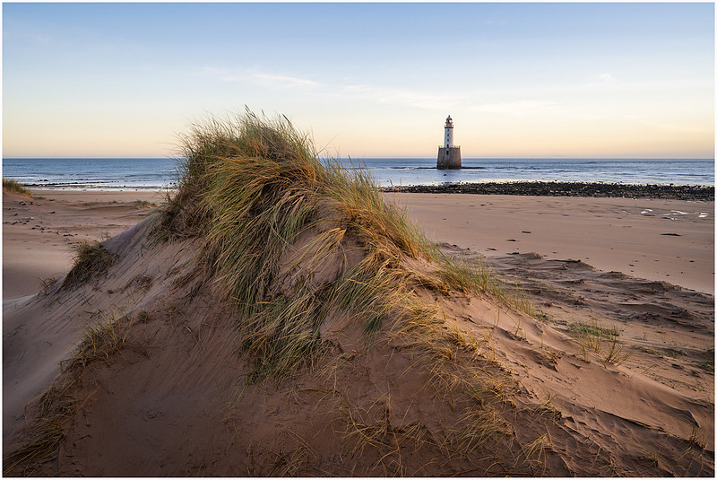
It was time to start making a move back to the van as I had another day of driving ahead of me. I stopped off at the dunes and grabbed my last couple of images of Rattray Head Lighthouse. I imagine it will be some time before I return again.
Golden sands
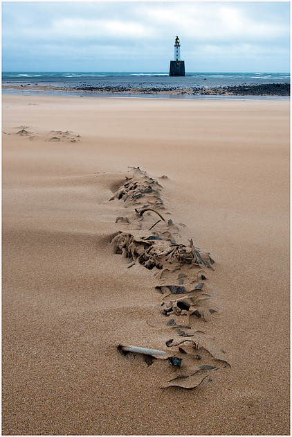
Windswept
Fairwell Rattray, it has been a much more successful visit. Until next time.
“He sat his ample backside on my tripod leg”
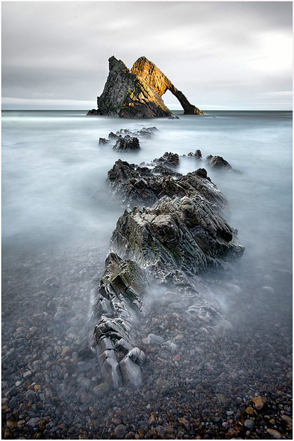
The previous evening, I had made the decision to totally ditch my itinerary and head further north before hanging a left and making my way inland to the Cairngorm mountains. From there I could decide if I should return via the west or east coast weather depending. So, my next stop was a short one-hour drive away at Portknockie. I was retracing a coastal route I took in February 2019 to reach Durness, and could not resist a quick stopover at Bow Fiddle Rock where, whilst managing to go apex over elbow running down to the beach, I had grabbed one of my favourite images to date.
Bow Fiddle Rock 2019
After a bit of lunch, we headed down to the beach before high tide. I spent a while setting up a very similar shot, but the wash of the waves was quite weak and the results were not best. I needed to wait for the tide to come in further. Max can sometimes get quite bored if I start faffin around “waiting for the light” and sure enough in the middle of taking a series of stacked images, he sat his ample backside on my tripod leg and trashed my composition. Revenge for bouncing him down the lane to Rattray?
Keeping Max entertained.
The light was coming and going, and I did have to get moving to make my next stop before dark, so I decided to take my last portrait image and go find an alternative angle closer to the sea, and further away from Max’s fat rear end.
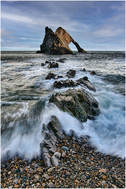
Bow Fiddle Rock 2022
I moved over to the right of the beach and went for a landscape image.
Trying a new composition
Edging closer to the waterline, I dropped my tripod into the calm water. With the wind blowing the clouds away from me I dropped in another NDF filter and went for a two-minute exposure.
The Return
The previous phone image was taken whilst the two-minute exposure was under way, and you can see how the cloud line has moved away from me and given a great feeling of depth to the image. Lifting the shadows and desaturating the blues gave a more pastel turquoise-blue feel to the picture. I was well chuffed with the outcome of my second visit to Portknockie, and this new capture reminds me of some of the surrealist painting I did as a teenager. This visit also reminded me not to become obsessed with one angle, but to walk around each location with camera in hand. Try out all possible angles, or even just take lots of phone pictures to see how they look. Instead, I had sat for over an hour waiting for the tide on a specific angle only for Max to trash my shot as he got bored. So next time, move around more before gluing myself to my tripod, and keep Max entertained. Time to head off inland with Loch Garten being my next destination.
“The stamping of heavy footwear grew louder”
The change in scenery was marked as I turned inland picking up the A95 at Keith. From here on I would follow the path of the River Spey from ‘Boat o’ Brig’ to ‘Boat of Garten’ before settling down for the night hidden in the middle of the Abernethy Forest surrounding Loch Garten. From sparse windblown coastal routes and beaches, I was soon bumbling through the lush golds and browns of autumn colours. The setting sun casting long beams of light through dense tree lined roads, twisting and turning through small crofts and villages as we made our way up and along the course of the River Spey towards the Cairngorms. At around 100 miles long, the River Spey is the eighth longest river in the United Kingdom, as well as the second longest and fastest-flowing river in Scotland, running more or less from Fort Augustus (where I would be spending a night sheltering from yet another autumn storm in a few day’s time) before entering the sea 5 miles west of Buckie. Shortly after passing the Tormore Distillery, I entered the Cairngorms National Park and began my ascent through Speybridge and on toward Aviemore. The call of nature was kicking in, so before I turned onto the narrow forest roads, I pulled into the visitor centre at Nethy Bridge for a ‘wash and brush up’. “Busy car park” I thought as I squeezed Mr T into the only remaining slot. Clutching my toilet bag and sporting 2 days of bed/hat hair and stubble I walked into the community hall only to be met with the sound of live music and laughter. The stamping of heavy footwear grew louder and the inner door burst open as several small children clad in kilt and sporran screamed their way past me wide eyed with remnants of cake stuck to rosy-red faces. “Wedding?”. Through the open door I was privileged to witness a traditional cèilidh with the bride and groom clearly getting stuck into the dancing. Thankfully no-one noticed the scruffy Englishman standing at the door, so whilst the heavy footwear continued to grind down the floorboards, I quietly made my way to the toilets for my ‘wash and brush up’. What a great surprise and a thing to behold. Time to make my exit. The last 4 miles from Nethy Bridge to Loch Garten take you through single track, tree lined, roads.
The road to Loch Garten
As I drove along, the low light was breaking through the dense forest now and then lighting up small Silver Birch trees whose leaves were the brightest golden yellow. I parked just off the main road in a designated spot where it is permitted to stay overnight. Just time for a short walk before dark to get my bearings and for Max to ‘stretch his legs’, so I grabbed my camera and headed towards one of the small golden trees I had spotted.
The jewel in the forest
Being accustomed to getting lost in a forest (long story) I could see that wandering from any sort of path was not a good idea. Neither was leaving a trail of breadcrumbs when you have hungry Max with you. It was getting darker, so I retraced my steps, and we headed back to the van before the light went all together.
My view for the night
It was soon dark, and I enjoyed eating my tea outside the van watching the stars twinkling through the canopy of the forest. To say it was quite spooky surrounded by such dense forest is an understatement in the extreme. I woke a few times convinced I could hear rustling in the trees. Maybe I did? Long day.
Day 4
Today was to be a forest exploration around the loch. I have been here a few times before now, but never really ventured that far. So, time to put that right and get out there for a full day’s exploration, as I planned to stay here for a second night. I might come to regret that decision.
“I thought I had stumbled upon a ritual murder scene”
The Loch Garten nature reserve is managed by the RSPB and is home to Golden Eye, Capercaillie and, amongst other birdlife, Osprey who can be seen fishing in the loch and River Spey. According to the RSPB website:
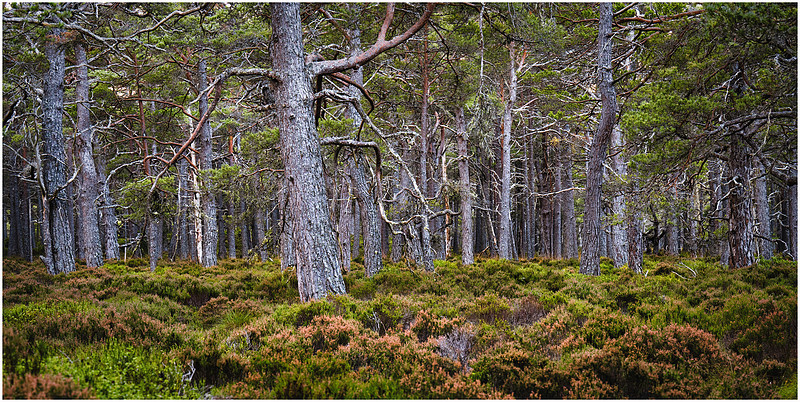
“The wildlife-rich Caledonian pineforest is like no other forest in the UK. Huge, gnarled, lichen-encrusted Scots pine trees dot the landscape, interspersed with other species such as juniper, rowan, birch, blae’berry and heather. Pinewood specialities like twinflower and creeping ladies tresses are to be found, nestling in the lush vegetation. A myriad of fungi helps to break down the deadwood, a vital component of a healthy forest. The heather between the trees continues through the forest edge, to form stretches of moorland. In August, the hillsides erupt in a riot of fragrant purple heather, attracting nectar-seeking invertebrates. Rich, peaty-brown water flows in the rivers and fills the lochs. Brightly coloured sphagnum mosses act like sponges and store water, creating invertebrate-rich, boggy areas. Scots pine trees grow pale and stunted in bog woodland, a rare habitat with specialist species. Formed by volcanic activity and shaped by glaciers, the sub-Arctic plateau of the Cairngorm Mountains is unique in the UK. Rare, fragile plant and lichen communities survive the sub-zero temperatures and hundred-mile-an-hour winds in the winter, alongside hardy ptarmigan. As well as Ben Macdui (1,309m), Abernethy holds several other peaks, including Cairngorm (1,245m), Bynack More (1,090m) and Meal a’ Bhuachaille (810m)”.
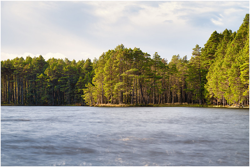
My first destination of the day was the far side of the loch, and I would get there by hugging the shoreline, grabbing images as I went along. From the van I followed the path along the edge of the loch, dipping in and out of the tree line. One of those “sunshine and showers” days when the low autumn sun shone threw it would light up the darker parts of the forest showing you the golden birches hidden within. I was aiming for a small area I could see from where I had parked that appeared to have a small beach. Movement in the trees up ahead. Clothing scattered across the shoreline and much screaming from the loch. I thought I had stumbled upon a ritual murder scene rather than a gathering of ladies taking a wild swim in the loch. Wild swimming seems like a good idea, but judging by the amount of screaming these ladies were doing as they waded into the loch, maybe it’s a pastime for summer only? The one and only male had the right idea staying on the shore and filming their pain. Smart thinking. The light was catching the trees across the loch so time for some photography whilst Max chewed on a few sticks. For my first shot I wanted to remove some of the distraction in the dark choppy water so dropped in my circular polarising filter to maximise the reflections and a 6 stop NDF to give me a total of 2.5 seconds at f/8. Just enough to smooth the water out a little but not too much movement in the trees. I got the camera low down to the water’s edge and waited for the wind to die down for a few seconds.
Loch Garten Autumn colours
I love how the low light is penetrating the tree line lighting up the trunks of the densely packed trees. When standing on the edge of the loch the ground beneath you is quite springy, almost like a trampoline. I found a spot where the water had eroded the bank and you could see that what you were standing on was not solid ground, but a network of tree roots forming a platform out over the water.
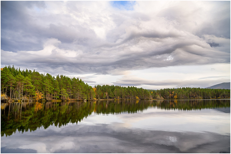
At some spots you could see water beneath your feet some distance from the visible waterline. I left the wild swimmers to their wild “fun” and Max and I moved off along the shoreline heading for the trees I had just captured in my first image of the day. The only sound as I made my way along the shore was the lapping of the water on the shore, the wind in the trees and the frequent sound of snapping twigs under my size 11’s. I’d never be any good in the SAS. It was a lovely morning, and I enjoyed walking quite some distance around the loch moving in and out of small bays and alongside boggy reed beds making sure we did not disturb any wildlife. The wind had dropped, and the forest fallen almost silent. Looking through the trees I could see the clouds were forming some very strange shapes, so I headed to the shore and pointed my camera back across the loch.
Cloud formations over Loch Garten
My basic meteorological skills cannot fully explain this phenomenon, but for a period of around 30 minutes, the wind at water level dropped completely turning the loch into a mirror as strange twisting clouds moved across from the direction of the Cairngorm mountains. With the presence of some lenticular clouds in the distance, I could only assume this was the movement of a front across the mountains. Pretty soon after this image was taken, the wind picked up again and the loch returned to being a choppy mess. At this point the path turns inland away from the protected areas of the shore around Loch Garten and the nearby Loch Mallachie. Here there are nesting boxes for the tree-nesting Goldeneye ducks. The Goldeneye is listed as an endangered species and the RSPB do great work here to help protect them. Time for me and Max to explore inland. We followed a narrow twisting curved path that slowly took us back around the loch. Dipping in and out of the treeline we found many patches of gold hiding in the depths of the forest.
Golden treasure
Playing hide and seek
Lighting the way
Eventually I could see the loch again appearing through the dense forest and we headed back toward the water.
Heading back toward the loch
As we emerged from the forest once again, I found this small island just offshore. The sun was getting lower and casting a lovely golden colour on the reeds.
Afternoon sun
What a great day’s walk around Loch Garten. Woodland photography is not easy, and not something I normally do, but the Abernethy Forest delivers a plethora of photographic opportunities even for a relative woodland novice like me. I highly recommend a visit along with a stop at the visitor centre where you can hand feed birds, who have become so accustomed to humans they will land on your hand for a treat. Donna and I were here a few years ago when staying at Boat of Garten and paid the birdies a visit.
Visiting the birdies
Time to head off back to the van and spend the afternoon processing images from the last few days. Tomorrow we head off on the second part of our Autumn adventure round Scotland.
Join me in Part II as Max and I head off from the Cairngorms and plot a course to the North West Coast of Scotland, drive for miles down single track roads, stay over at deserted white sand beaches, stand in awe of the majestic Assynt Mountain range and come unstuck with a group of German tourists.
Loughrigg, Grasmere and Twistleton, England.As planet Earth rotates around the sun each year, so the seasons come and go as the days grow longer and shorter. For a few months each year the time between sunrise and sunset becomes a matter of a few hours during winter. But before that, we have that magical time we call ‘Autumn’.
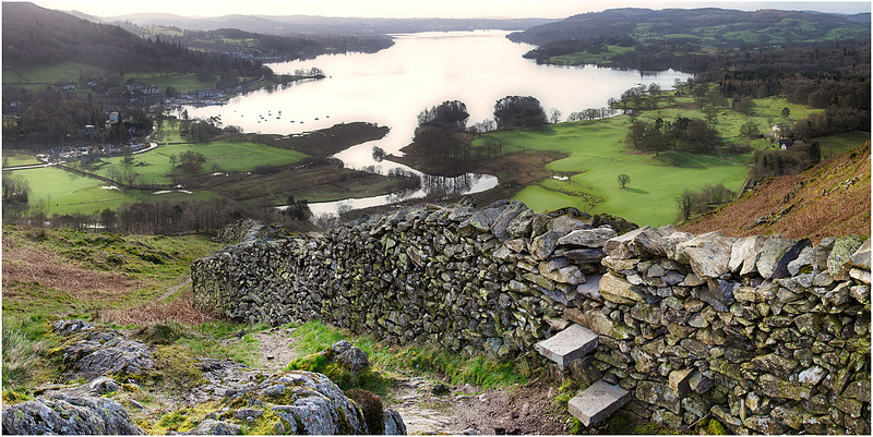
Ten hours or so of daylight, frequent sunny days, and the change from greens to a multitude of shades of golden brown. Autumn is the busiest time in my photography world, and I can squeeze in both sunrise and sunset photography on the same day without having to get up at silly o’clock. And so today the forecast was for long sunny intervals, the leaves were changing colours, it had been raining the last few days, so I planned to watch the sun rise and set with camera in hand. Due to the heavy rain for the last few days and a drop in temperature as a high-pressure system passed over the UK, mist and fog was a strong possibility. I was on it. My first destination for the day was to be Loughrigg Fell and involved an ascent in the dark to a height of a little over 1,100 feet from the Rydal Water side of the fell. Previously, in 2019, I visited Loughrigg Fell, choosing to climb from the Ambleside route in search of a photogenic wooden stile and dry-stone wall I had seen in a guide book. I wandered up and down the fell for a good hour checking and cross checking my map but could not seem to find any wooden stile. After a few more checks, including looking up the guidebook on my phone, I realised I was too late. The wooden step stile had been upgraded to two simple stone steps. Not quite as pretty, but I had come this far, and that tree down on the shores of Windermere was catching the light nicely.
The missing stile
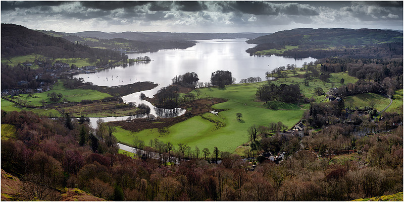
I climbed over the stile and headed up higher to get a panorama shot of the lake and the shore. The solo tree down at Clappersgate was getting my attention once again so I waited for the sun to break through.
Windermere from Loughrigg Fell
Back to 2022 and just a few weeks earlier I had visited Loughrigg Fell once again and climbed to the summit having parked at the White Moss car park near Rydal Water this time. It was a typical Lake District day of sunshine and frequent blustery showers. I had my waterproofs on from the moment I left the van. As I was climbing up from Loughrigg Terrace, showers were blowing through creating magical rainbows. This was what I had come for, so after grabbing a quick phone shot, I headed up the steep path to the top.
First rainbows of the day over Grasmere
It was very busy at the summit and very windy. Even Max was being blown around and getting wet. It rained solid for most of the time I was there so whilst I did attempt some photography, conditions were difficult and output not so good.
Max’s wind flapometer
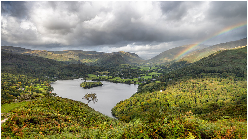
All I was doing was getting very wet, whilst trying to keep my camera dry. On this day I had only brought my Nikon Z50 cropped frame camera, and this is not fully weather sealed, so I made the decision to turn back and descend to a spot where I had seen a solo tree jutting out from the side of the hillside. I think Max was quite pleased as driving wind in his eyes and ears is not much fun and he looked quite glum. I moved left and right, and up and down until I was happy with how this tree lined up with Grasmere and the island in the middle.
Getting the composition right
The wind and rain was relentless Max and I hunkered down on the hillside trying to avoid the worst of the rain and stay dry. When I say dry, I mean myself of course as Max did not have his jacket on. It was in my pack, but by the time I remembered he should be wearing it, he was already soaked, so in the pack it stayed. Bad Dad! The heavy shower began to move away towards Helvellyn and I could see over my left shoulder the sun was starting to break through. You can almost guarantee a rainbow any minute, so I grabbed the camera out of my bag and got myself primed. I was rewarded for my patience.
Grasmere rainbow
Those few minutes in-between showers were amazing as the warmth of the sun came through bouncing off the wet bracken. I stuck it out for a few more showers but was not rewarded with any more rainbows. So given Max was by now looking pretty hacked off sitting on a steep hill sheltering from the rain in the bracken, I decided it was time to begin our descent back down to Rydal Water and home.
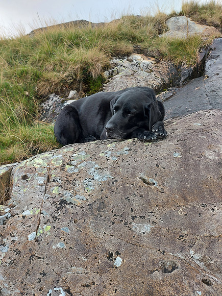
Not the happiest pooch
I stopped off halfway down on Loughrigg Terrace as some pretty heavy squalls came through but there were no following breaks in the clouds for the sun to paint the amazing rainbows. I did have to resort to using my shower cap though.
The rain had set in for the day now so we retreated to the van and Max got dried off and into his drying jacket before falling asleep in the van on the way back home. I had found a great spot and super composition, so I decided I would be back soon when the weather improved.
Two weeks later
Today’s trip was promising no rain, and plenty of sunshine, so at 4.30am I headed out in the van up the M6 to Cumbria. Max was staying home today as I intended walking through a lot of bracken and right now the ticks were out in force, not to mention his nasty habit of eating acorns making him quite unwell. By the time I had crossed the river joining Grasmere with Rydal Water and ascended to Loughrigg Terrace, the blue hour was upon me and I could see a distant orange glow already. It was still dark enough to need my head torch though as I turned a sharp left at the end of the terrace and began the steep lung busting climb up towards the summit. I had driven through the odd foggy patch on the way through Windermere, and I could make out what looked like mist at the opposite end of Grasmere, so fingers crossed. I climbed a little higher on this visit putting a little more distance between the one tree and the island in the lake revealing more of the shoreline that was in the mist. I should probably say “in the middle of the mere” but that just sounds a bit weird. Apparently, a Lake is a deep body of water, whereas a Mere is shallow. That right?
Today I planned to create a multi-image stitched panoramic image using just my prime 35mm f/1.8 lens. Why do this rather than just throw a wide-angle lens on and grab it all in one shot? Two reasons:
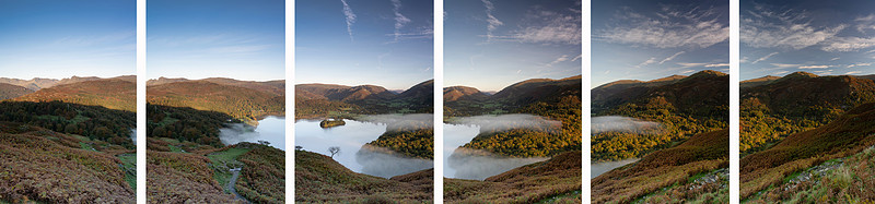
Let me talk you through the concepts of this technique. By turning the camera into the portrait (vertical) position you can take a series of multiple images across your view as shown below. This can be done handheld, but it is highly recommended you do it on a tripod so it can be absolutely level. This way you avoid losing large portions of your image when stitching them together and it is repeatable with the same results each time.
Unstitched portrait images
First of all, make sure you tripod head is absolutely level using the spirit level indicators if you have them. I also recommend attaching your camera using an L-bracket rather than tilting the tripod head from horizontal to vertical. This way the sensor in the camera will pivot over the centre of the tripod rather than swing around in an arc as would be the case when just tilting the tripod head. You need as little distortion or change in your sequence of images to enable them to be stitched, and a camera swinging through an arc will create minor differences in angle and make stitching difficult or even fail. The same goes for the lens. Wide-to-zoom lenses tend to have quite a bit of edge distortion as they battle to be a lens for every occasion. This is even more exaggerated with a pure wide-angle lens but when taking a single shot does not became apparent unless you are in the city where you will see straight lines curve towards the edge of your frame. To keep distortion down I always try to use a prime lens such as 35mm or 50mm lenses. These tend to be faster lenses so great when it’s dark and have next to no distortion around the edge of the frame. What this means is as you rotate your camera and take each of the images the edges of each successive image line up with next to no distortion. Your software will love this and make for cleaner stitching of the images. Once you are set up, you can rotate your camera from left or right (I always go left to right from habit) and take a series of images.
Some top tips:
I use Lightroom to stitch my pano’s but there are many other applications out there that can do this for you.
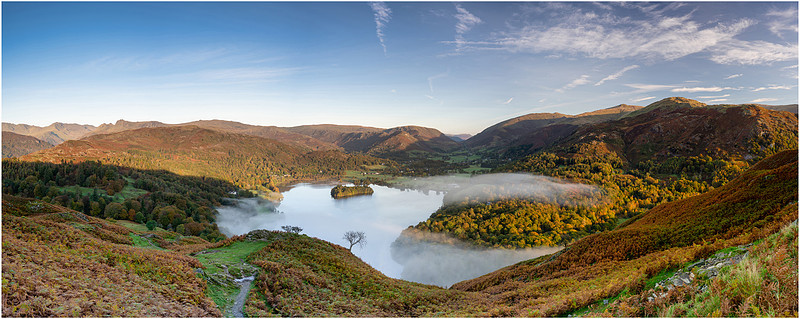
Stitched panoramic image of 18510 x 7389 pixels and 84.7Mb in size
The number of pixels captured means you can zoom in and crop to create many images out of one. Here is a square crop of the island.
The final crop - Grasmere in the mist
I love this image, and it was exactly what I had in mind as I drove up the M6 towards Cumbria that morning. The mist would form and disappear like magic, rolling across the mere and into the trees. I had looked at PhotoPills the night before and could see that the rising sun would flood across Rydal Water and up the valley below me well before it reached me on the north side of the fell. This has given some great warm morning light on the trees in Baneriggs, super enhanced by the mist.
PhotoPills planner
A great result and a great morning climbing this popular location. I couldn’t have asked for anything better to be quite honest. Time to pack up the camera and head back down off the fell and on to the next location. I accidentally fired off a frame as I was taking the camera off the tripod. I quite like it, maybe it will win the Turner prize? Maybe I could start a new photographic genre called ‘Accidental Intentional Camera Movement’ or AICM?
AICM Premier
It was just after 9am when I got back down to the shores of Grasmere and whilst I contemplated my next move, the local wildlife obliged with a few poses for me.
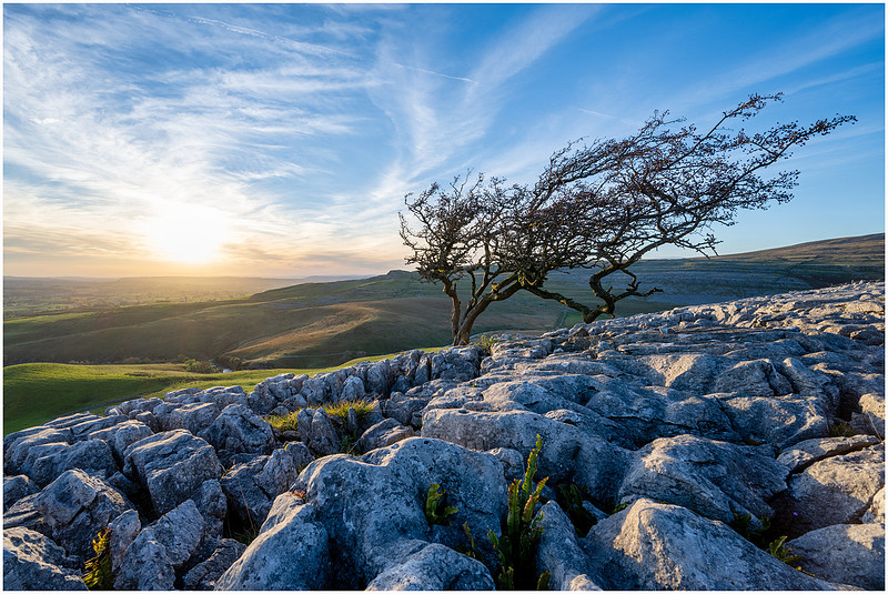
Whilst having breakfast on the shoreline and watching the comings and goings of this Heron, I decided I would move on to Twistleton Scar in North Yorkshire. I had been there a few years previous in some pretty dire weather so not ventured far. Last month, whilst on a family camping trip, we walked around Ingleton Waterfalls stopping for the obligatory ice cream just above the main waterfall. The ice cream van parks right below Twistleton Scar and I said to Donna, it was definitely time I went back. It's quite difficult manoeuvring across the limestone rocks, so not a place to take Max, so given he was at home with Donna, and we were in for a great sunset, Twistleton Scar it was and off I set. Twistleton is a long series of limestone scars lying along the flank of Whernside above Chapel-le-Dale. There are many weather-beaten and twisted trees growing out of the gaps in the limestone along with interesting pot holes and shakeholes galore. I’ve always said you could blindfold me and drop me in North Yorkshire and I would know where I was purely by the limestone rocks and scars you find all along the hills surrounding Ingleborough, Whernside and Pen-y-ghent. And if those 3 mountains sound familiar, well they are as they make up the three destinations in the Yorkshire Three Peaks Challenge. A 24 mile (12 hour) route with 5200 feet of ascent. Never mind that, what are shakeholes? I hear you ask. They are one of the reasons you avoid taking your dog up on the scar. Think of holes in the ground that lead to dark unexplored caverns. I wouldn’t go caving if you paid me a large sum of money, and just looking at sink holes that disappear into the abyss gives me the heebie-jeebies The most common around Twistleton and Ingleborough are subsidence dolines known locally as Shakeholes. That said, above Twistleton scar lies a mighty fine solution doline known as Fluted Hole. According to the Yorkshire Dales National Park website: “The Fluted Hole on Scales Moor has beautiful symmetrical plates of fissured limestone surrounding the central hole like petrified flower petals – while others see it as a group of stone doves drinking from a birdbath! Any large solution dolines must be very ancient as dissolution is a very slow process. Many of them pre-date the last glaciation and were over-ridden by ice during the Devensian.” Today, however was going to be a sunset shoot lower down at Twistleton Scar end. Exploring Scales Moor will be left for another ‘Max-free’ day. I parked the van at the top of Thornton Lane and walked past Thornton Force Waterfall towards the popular ice cream van that is always parked at the top of the Ingleton Fall trail. Just after the van you take a sharp left and a steep climb to the top of the scar where you will find these two prominent bent trees. These two lonely sisters can be seen from Thornton Lane so act as a good beacon to follow.
The twisted sisters
I intended to return to these ladies as the sun was setting so carried on further up the scar following the pathway towards Scales Moor. I wanted Ingleborough as my backdrop, so hunted around to find a suitable foreground of limestone pavement and a solo tree. Plenty examples up here so it wasn’t long until I found this spot. I set about the task of trying to find that right angle and composition. But there were so many!
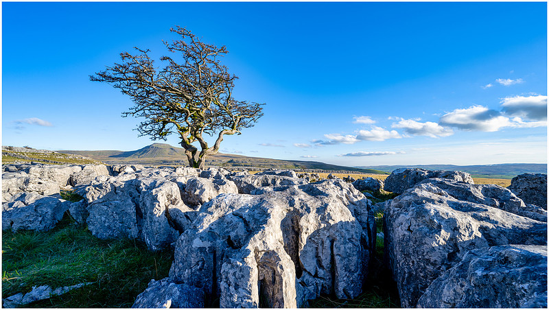
My challenge was getting the three elements of my image to play ball. The great formation of the limestone pavement, the gnarly weather-beaten tree and Ingleborough in the distance. I needed to make sure the three elements worked together but didn’t interfere with each other if that makes sense. There was also another tree in the distance just the other side of a long dry-stone wall. A couple of photographers were at that tree moving in and out of my shot. I opted for my 14-30mm f/4 wide-angle lens to get everything in. For my first image I settled on having Ingleborough sheltering under the branches of the tree. The limestone pavement and clouds were both acting as leading lines towards the tree so I pushed it and Ingleborough over to the left of my composition.
Twistleton Scar and Ingleborough
This was probably going to work equally well as a portrait shot and was a good starting point. It was cold up on the exposed limestone pavement, but the sun was out and no shortage of seating up here. I spent a bit of time trying different angles, balancing precariously on the top of lumpy bits of rock or lying on the floor to get a close up. I decided to do a little black and white too and try that portrait angle.
Standing tall and strong
You have to admire how these trees have not only gotten a foothold in between the limestone rocks, but how they have withstood the weather up on the exposed slopes here. I can only imagine what it is like up here on a bleak winter’s day. Maybe a return visit soon will show me exactly what it is like. Sunset was a few hours off, so I settled down with my book and put my feet up.
I could have explored more, but I had been on the go since 4:30am and even managed a little snooze. I had a minor panic when the sun went in completely for a while, but the clouds cleared, and the warm rays of the setting sun began to creep across the limestone. It was looking great.
Sunset on Twistleton Scar
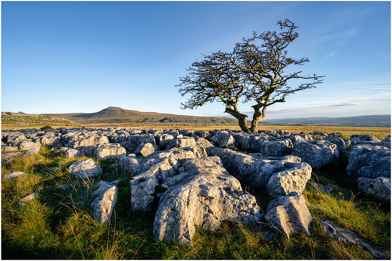
In my final image in this location, I separated the tree and Ingleborough to fill out the landscape orientation of the shot and brought in a grassy margin to the foreground. I was happy with this image and more determined to spend a full day here on the next trip and head up to Scales Moor and find more compositions. This is clearly a great sunset location and I want to get more of Ingleborough into my shot. So, moving on, and you will remember the twisted sisters from the first part of my walk up to the scar. Well now it was time to return for my final image of the day. The sunset was forming up nicely over Morecambe bay, with wispy ‘mare’s tails’ clouds and low sunlight catching the curves of the hills. I decided to point my camera right into the sunset and drop in a graduated filter to try and keep the details of the cloud whilst exposing for the limestone rocks and the trees. I scrambled up on to the limestone pavement and wobbled around as some of the large boulders do move as you step on them. I found a great spot with a few wild plants and flowers growing in the cracks of the rocks and settled down as the sun sank further. Shadows started to creep across the landscape in front of me and the harsh light of the sun bean to be filtered by the low cloud over the bay. I hit the shutter and checked the image on the back of the camera.
Morecambe bay sunset
I did take some more shots, but it was this first one that was the keeper. The curve of the hill at Raven Ray just above Thornton Force waterfall caught the light beautifully. In the bottom right corner of the mage is a single delicate purple flower. I always try to make my images tell the story of the trip, of the day, of the journey and this one image said everything about those last few rays of light and my journey. If you zoom in and look carefully under the arch of the tree branch, you will see the footpath in the distance leading to Thornton Lane, and there parked next to the gate is Mr T, my van.
Mr T waiting patiently in the distance
Image taken, it was time to pack up and start to make my way down off the scar and back to my waiting van. Dreams of an ice cream on the way back were dashed as he had already done a runner for the day. What a great day’s photography! A lung busting climb up Loughrigg in the dark to witness the sunrise over the mountains of Cumbria, watching mist forming over Grasmere, another climb up Twistleton for the most amazing sunset views out to sea from Yorkshire. I will be back very soon, heading straight up to Scales Moor as I’m sure there is much to be found up there.
Maybe I will find the Fluted Hole without falling in.
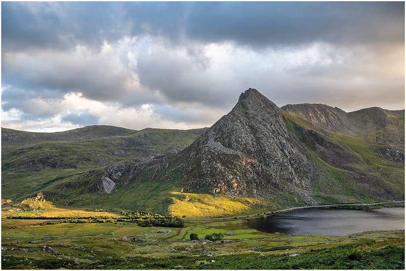
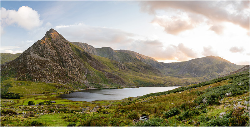
Tryfan, Snowdonia National Park, Wales.Tryfan looks almost like a three headed fin, hence its name derived from ‘Tri-faen’ or ‘The Three Rocks’. Upon reaching the top you are faced with the twin summit pillars ‘Sion a Siân,’ (to the Welsh-speaking locals) or ‘Adam and Eve’ to the rest of us. Gather your spirits and your courage as you must now leap from one to the other to gain “the freedom of Tryfan”.
Here is where you stop being an ordinary hiker and venture into the empires of the mountaineers. It is not for the faint hearted, and as my days spent around Tryfan and the nearby ‘Devils Kitchen’ in the Scouts are long behind me, I prefer the slightly more leisurely pastime of photographing this monolith from afar. I was here four years previous and climbed up the same side of the Ogwen valley towards Ffynnon Lloer. I was on my way to Anglesey for a sunset shoot out at South Stacks Lighthouse so stopped in on the way mid-morning for a walk up to the waterfalls. I had spent most of the time wandering up and down the river finding a composition. Moving around on this hillside is quite difficult near the river, with many large boulders and thick bracken and spikey gorse to fight your way through. I managed just the one keeper that day.
Orographic clouds over Tryfan (2018)
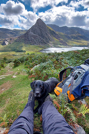
I was happy with the composition, but I was there at the wrong time of day. The sun was directly over Tryfan casting dark shadows across the face of the mountain and I had to wait for a cloud to obscure the sun to get a reasonable shot without any blown-out highlights. So, four years later I was back and this time I knew what I wanted and when I needed to be there. I spent the morning having a leisurely breakfast at the newly built zip wire centre near Betws-y-Coed before moving to Llyn Ogwen just after lunch. I wanted to climb higher up this time, before descending as the sun was setting grabbing several compositions on the way back down, so I expected to be on the hill for a good six hours. Max was along for the ride once again, so we packed tea for both of us, grabbed my camera gear and left the van on the A5 next to Glan Dena. I had forgotten how tough the climb is up this side of the valley, or was it just the last 2 years stuck at home, but I was huffing and puffing all the way up.
Pit stop
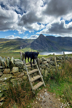
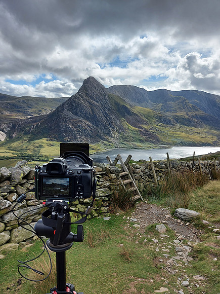
We focussed our ascent toward the dry stone wall two-thirds the way up to Ffynnon Lloer. Here was a wooden stile I wanted to include in my first image. I had seen it on my last visit but did not go this high. Having had a pit stop, Max took the lead and pulled me up the rest of the way to the wall. To be honest I more or less fell over the top collapsing in a heap on the other side, much to the amusement no doubt of Max, and the elderly gentleman resting on the other side with his pack lunch.
Max making it look easy
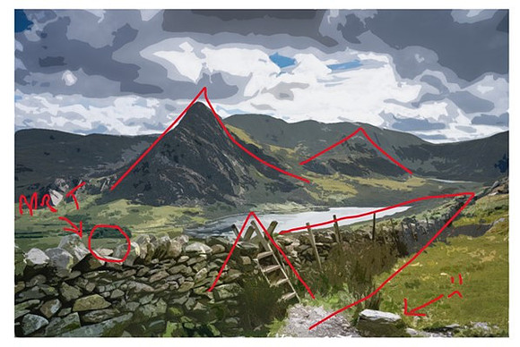
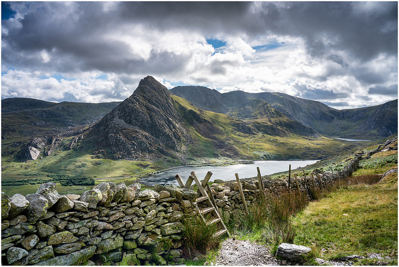
Having got my breath back (I was puffing like a steamer), I set about finding the right spot to stand and get the best composition. There were 5 key elements in the image I needed to get right: Tryfan, the dry stone wall, the stile, Llyn Ogwen and the small curved path from Glan Dena where I started my climb. Tryfan – not an awful lot of angle changes you can make from this far away, and it was looking at its best. All that was needed here was the right light. The wall – Snaking for some distance, it gave great perspective and a leading line towards Llyn Idwal sitting below Devil’s Kitchen at the end of the valley. It was a shame there was also a wire fence along the wall but clearly the sheep had been getting over. What I needed to make sure was none of the wooden fence posts managed to cross Llyn Ogwen in the distance otherwise it would create a split image. A lake of two halves if you will. The Stile - An almost perfect mirror image of Tryfan, repeating the shape. The top of the style needed to be isolated and not interfering with the background. Llyn Ogwen – I didn’t want the top of the wall obscuring the lake, preferring it to be framed where possible by the greenery of the shore or the hillside. Glan Dena path – After you walk through the trees next to Glan Dena at the beginning of the climb, there is a lovely s-shaped path that curves around a rocky outcrop. I wanted this visible and uninterrupted as it is all part of the story of how I got here. I was almost tempted to run back down and move Mr T so he was visible parked on the road at the entrance to the path. But clearly, I’m not quite that insane. I walked up and down trying to find a way of aligning all these elements, much to the amusement once again of my spectators. I found the only spot where the stars aligned was with the camera at its maximum height on the tripod which required me standing on a rock behind it.
Aligning the stars
It was 2pm by now and the sun was more to the right of Tryfan casting better light than in 2018. The stile was a copycat on Tryfan, with the ladder aligning with the north face; The tops of the wooden poles and stile were floating in the lake; and the s-shaped path was snaking into a small low part of the wall between two larger rocks. My only distraction was the large rock at the base of the stile, but there was no way I was moving that.
Repeating triangles and leading lines
The scene was set, all I had to do now was wait for the right light whilst I ate my chicken sandwich and Max munched on a carrot.
Tryfan, the stile and Llyn Ogwen
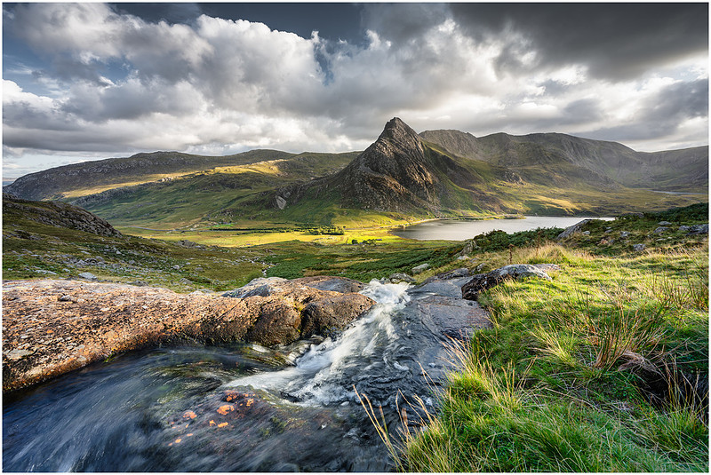
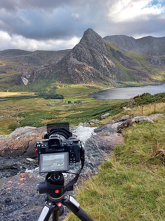
Whilst waiting for the light to change, I chatted for a while with the gentleman on his way down from Pen yr Ole Wen who was very much looking forward to a pub tea in Betws-y-Coed, and couple on their way up for a swim in Ffynnon Lloer. I had put several layers on since crossing the stile and this couple were still in t-shirts heading for a wild swim and an overnight camp. Tougher than me on all counts. The light was OK in my first image, but not spectacular. I’m sure it would be fantastic at sunset, but I hadn’t come all this way for just one composition. Time to start heading down and find a location next to the waterfalls for a sunset shot. I can always come back here another day. I had plans to find the same location as last time for this next shot, but you know what? I spent far too long trying to find it climbing up and down boulders, jumping the river back and forth and getting attacked by the gorse. I just could not find it and it was coming up for 4.30pm so I needed to get that composition nailed soon. I made my last jump across the stream and found an s-curve once again, but not in the path this time, it was in the river as it cascaded over the rocks. This was good, the curve was creating white water, the stream was leading towards Tryfan and my s-curve was repeating in the path down at Glan Dena. Maybe I am obsessing a little over this path?
The light was changing all the time, and you could watch it travel across the valley below. Time to sit back and wait as the sun began to dip towards the top of the mountains to my right.
Enjoy the sounds of the waterfall and watch the light move across the valley floor.
Time for a kip
Just before 5pm, I was blessed with the magic light across my scene and snapped away.
Sunset over Tryfan
These colours would look great back up at the stile, so it looks like another visit is on the cards after all. Time to head down now and along the way I grabbed a few hand held shots as the sun set.
Mr T stealing the light
The last rays catch the summit of Tryfan
What a great afternoon climbing up for the view, and I was really pleased with what I had got. Mission accomplished, but I will be back, maybe when there is snow. Maybe I will find that composition again from 2018? It was dark by the time I got down to the road and I was ready for a warm drink and something to eat. Parked right on the road, I was in for a rocky night’s sleep as wagons passed by until around midnight. Not to mention Max had eaten his own body weight in sheep poo, so it as going to be a windy one too. Tomorrow I’m off to the slate mines. Rock and roll!
Sixpenny Handley, Dorset, England.
Sixpenny Handley is a quiet village situated on Cranborne Chase just inside the county of Dorset. After a great fire in 1892 destroyed most of the village, so much help was sent in the form of clothing for the resulting homeless that it could be said a man could be identified as being from Sixpenny Handley because he wore two or even three waistcoats.
Now I like a good tale, and I like a good quirky village name, and I equally like a waistcoat of jazzy colour, but it wasn’t the prospect of walking around wearing multiple layers that was drawing me to Sixpenny Handley, it was something slightly less remarkable, a barn in a field. It was the start of a seven-day photography trip to Dorset and Devon in July 2020. This was my first trip out of the pandemic, where up until now I had been keeping myself sane taking pictures of every flower in the garden. My first day involved a 250-mile overnight drive through Salisbury, bypassing Stone Henge, to find an elongated kite shaped field just outside the village of Sixpenny Handley. In that field stands an old Dutch barn. The weather forecast was good, with clear skies, sunshine and little wind. I wanted to be there for sunrise and was praying for a little bit of atmosphere thrown in. The temperature overnight had dropped after a day of rain, so I had one thing on my mind and that was MIST. Actually, I had more than one thing on my mind as I found myself bumping along country lanes in the dark. My other thought was about freedom, and how we had all been deprived of this for so long. Trapped in our homes, with one walk a day at best was awful for all of us. Now I was out in my van (Mr T), heading to the other end of the country for a week of fresh air and hopefully some great locations.
“It was a deep grunting bark, and it came from the middle of the field”
Just after 3am I arrived in a small layby near the barn and headed straight down the road, guided by my head torch to find the best spot for the sunrise. My wishes had come true, and I could see some mist forming in the field as I shone my head torch over the hedge. I followed the road finding gaps in the hedge where I could point my camera at the barn. Let’s not forget this is a farmer’s field with a crop of wheat on its way to be harvested very soon, the last thing they need is me tramping through damaging the crops, so I was staying outside the hedge looking in. But I could get my tripod over the hedge and get close to the wheat. As the glow of the rising sun started to fill the field, the mist was forming on the far side. Perfect. Time to grab my first image of the day, my first image out of lockdown, my first image of freedom.
Fields of wheat at Sixpenny Handley
I wanted to get closer, and when walking down the road I had noticed a gate into the field with some tracks in the crop where I assumed the wheels of the farmer’s vehicles had been. These looked like some great leading lines into the barn itself. I was packing up my camera to go back to this spot when I heard it. It was like a bark. It was a deep grunting bark, and it came from the middle of the field. I looked over to the right of the barn and there in the distance were a pair of antlers emerging from the wheat. A glorious pair of antlers twisting and flicking as a deer moved through the crop. Then he raised his head and let out another bark. Too far away to see, but I imagined seeing its breath in the cold misty air as he barked a warning. I had been spotted, and whilst I scrambled to get my camera back out of the bag, he turned and gracefully leapt through the crops away from me and into the distance. What a privilege, what a sight. One minute earlier and it would have been in my frame. To quote a famous politician, “Them’s the breaks”.
“I just couldn’t seem to focus”
The sun was threatening to break the horizon very soon so I quickly repositioned myself back up the road where I could be a little higher and zoom in on the barn. The vehicle tracks were creating a small s-curve in front of the barn giving me a nice leading line. The mist had also rolled closer to me and it was all coming together. I had a few minutes until sunrise so set about getting my composition right and taking a few test shots. I swapped over from my wide angle to my 18-200mm zoom so I could get more of my subject in the frame. But, something wasn’t quite right, I just couldn’t seem to focus. I use what is known as ‘back button focussing’ which is where I have switched off auto focus on the shutter button so autofocus can only be activated from a button on the back of the camera. This way, I can set the focus in my image and take as many shots as I like without it trying to refocus on each press of the shutter. Each time I pressed the focus button the lens hunted for focus out then on the way back would grind and stop. I went to grab the focus manually using the lens ring and I felt the unmistakable grind in the mechanism. Sand! It could only be sand or grit had gotten into the mechanism of this lens. This was a challenge, but I had to work through it and push the lens focus ring through the grind and get the focus. I only had a minute or so before sunrise and no time to change lens and reset my composition. I set my aperture to f/8 to give me a reasonable depth of field and managed to get focus on the barn with the help of a bird that landed on the roof. The sun broke the horizon to my left and lit up the mist in the field turning everything gold.
Golden sunrise at the Dutch Barn.
There was no noise, the road behind me was silent. All I could hear was the occasional chirp of the small birds in the hedgerows. I took it all in and enjoyed the moment grabbing several images. I wasn’t the only one, clearly the bird on the barn was also enjoying the sunrise and had a great viewpoint. I flipped my camera to portrait to capture a great little cloud that was above me and got some more of the golden light and shadows on the wheat in front of me.
Dawn colours across Sixpenny Handley.
What a great moment to have experienced as my first morning away from home after the pandemic. All those hours, days, weeks and months we had all been forced to stay home and stay safe, my first real trip away had given me this moment. Seeing the solitary deer in the mist made it all the more special. Did you know Reindeers are the only species of deer where the females grow antlers? Whilst the males grow their antlers for fighting in the rutting season, the females grow theirs for finding food in the snow. This means the males shed their antlers in Autumn after the rut, but females keep theirs until spring. So, was Rudoph actually a girl given he/she was pulling the sled for Santa in December? Well no, as most of the reindeer used to pull sleds are castrated males as they are easier to handle, and therefore have antler cycles similar to those of the females. There you go! Poor Rudolph, I‘m not surprised his nose was glowing. Just under nine miles away was my second location for the morning, and the combination of mist and clear sunrise was going to be perfect. As much as I wanted to just stay and soak up this atmosphere, I needed to move on.
“The whole village was completely sunk beneath the lake”
Moor Crichel, like Sixpenny Handley is a small village nestling in the classic English countryside within Cranborne Chase. Crichel House stands proudly within the Crichel Estate overlooking the ornamental gardens and lake. The original Tudor house, owned by the Napier family, was largely destroyed in an accidental fire in 1742 and was rebuilt by ‘John Bastard of Blandford’. I like that name, and it seems accidental fires were all the rage back then. Humphrey Sturt, of Horton, in Dorset, acquired the estate in 1765 and extensively remodelled the house. The ‘remodelling’ involved moving the entire village of Moor Crichel a mile to the south so he could create a new lake in the grounds of the house. The whole village was completely sunk beneath the lake, thankfully he did stop short of moving St Mary's Church, which remains today. Back to my reason for being here and my journey to Moor Crichel would take me along a beech tree lined avenue. A long, straight well-kept narrow lane of beech trees should make a great image in the mist. I drove along the avenue before parking up and turning to look back to where I had entered the village.
Beech tree lined avenue at Moor Crichel
The mist was rolling in and out and, in this image the direct sun was very much diffused in the fog. Standing here fiddling with a lens that was refusing to focus was a bit of a faff as it wasn’t exactly an empty road despite it being a little before six in the morning. I managed not to get run over and as the sun started to appear through the mist, I moved myself over to the grass verge for a portrait shot.
The avenue
What a great place to drive through on my journey to the Dorset coast. I didn’t have time to drop by the Estate, but here is a little historical fact about it. Crichel Estate was the home of Princess Charlotte (Granddaughter of Mad King George). She was heir to the throne and destined to become Queen of England. But she had a disagreement with her father about a marriage proposal, so he banished her into isolation at the estate. Charlotte did happily marry, but died in 1817, aged just 21. Because of her untimely death, the next in line to the throne would eventually become Queen Victoria some 30 years later! Just outside of Moor Crichel lies the entrance to an ancient Roman road known as Ackling Dyke. An impressive structure running 22 miles from Old Sarum in Salisbury, to the Iron Age hill fort at Badbury Rings, which was to be my next destination. Built so well to move troops across the country, much of the Roman road is still visible today through agricultural land. Time was not on my side, so attempting the long hike through the fields was not my plan, opting for the 17 minute zip in Mr T. The rings were not my primary destination, more a place for something to eat and park before heading on foot down the Blandford Road. Another avenue of beech trees, however these specimens are over 200 years old and form a shady canopy right across this much wider and undulating road.
Shady Blandford Road
According to Dorset Life: “Born in 1776, William John Bankes was, as a young man, an aide-de-camp to the Duke of Wellington and became an active Member of Parliament. In 1835 he inherited Kingston Lacy. A good friend of Lord Byron from Cambridge days, he enjoyed liaisons with men and women indiscriminately and in 1841 he had to go into exile after being caught with a guardsman in St James’s Park. While in residence at Kingston Lacy, William John made many changes, including the installation of the Egyptian obelisk that may be seen in the gardens to this day. One of the first things he did was to plant a beech avenue lining the road from near the house’s entrance drive to beyond Badbury Rings. The road was a turnpike, and the Bankes family enjoyed the revenue from it. The avenue was a birthday gift to William John’s mother, Frances, and there were 365 trees on one side of the road for each day of the year and 366 on the other, for a leap year.” No standing in the middle of the road here to get the best shots.
Mother’s trees
This morning had been a great start to a trip to Dorset, and to be quite honest one of the most memorable. As I write this narrative some two years later, I still count it as the most spell binding ninety minutes standing on the edge of the field of wheat at Sixpenny Handley watching the stag wander through the crops as the sun rose and turned the mist to gold. But now it was time to find my campsite and catch up on some sleep having been awake for a good 28 hours by now. The weather forecast for the week was looking good and I had plans to walk the Jurassic Coast around Durdle Door, climb Combers Hill, walk to Old Harry Rocks and catch a glimpse of Comet NEOWISE along with some Milky Way photography during the upcoming new moon phase.
I’m going to need my sleep.
Sango Bay, Durness, Scotland.
Sango Bay sits just about as far north as you can travel on mainland Britain without needing a boat. The journey there will take you through some of the most scenic Scottish highlands, along coastal roads, through mountain passes and across deserted moorlands. I had five days to get there and back whilst calling in on too many locations to remember. I think I may have overcooked this one. . . . . . John Lennon had very close ties with Durness, and according to The Scotsman would visit in the holidays during his youth to stay with his Auntie. John would travel north with his cousin, who lived in Edinburgh, and spend time helping his Uncle fix up the house and basically messing about with his cousin out on the beach or up in the hills. I wanted to find out more, so Durness was to be my destination. I intended to get there and back via an anticlockwise route up the east coast of Scotland, across to Durness, continue down the west coast, before heading across the Highlands to the Fife Coast. St Monans Harbour would be my last location before heading back home. A round trip of 1055 miles, all in in five days. Ambitious? It was early February, so a trip this far north was going to be a challenge with only nine hours of daylight a day, but that means I can do sunrise to sunset photography for as long as my legs hold out. I had my warm gear, good boots and Max along for support. . . . . . Day one was the overnight scamper 383 miles to my first location at Rattray Head Lighthouse, north of Aberdeen. It was dark when I set off and dark when I arrived some 7 ½ hours later. Max is an absolute dream in the van, with a large soft bed on the floor behind me, a travelling bowl of water and securely strapped in with his seatbelt harness, he just jollies along for the ride and the walk at the end. Not that I’m Speedy Gonzales, but he has this great water bowl with a sort of small hole in the middle, a floating plasticy thing that he can sip water out of but no spills when cornering. Anyway, not a single complaint from him on the journey. Well almost none. As we turned off the main road, we began a two-mile bounce along a bumpy single track road dodging pretty big potholes and sheep in the dark. Max began to protest at this point, not only because I’m sure he was busting for a wee, but also I had found the operating limits of his water bowl. We arrived at a small car park about 100 yards from the beach, and as there were a few hours until sunrise, it was toilet break all round, mop up water bowl spillage and into bed for some rest. “Walk? Where is my walk?” It was windy. The van began its familiar boat at sea impression rocking back and forth, but after so many hours driving I soon fell asleep. Night Max! “No walk then?” At this time of year this far north, it only gets light just before 8am, plenty time for breakfast and a cup of tea. It was still very windy, but we got ready and headed off to the beach. Max was busting for a walk after the long journey here. I could hear him saying “This best be worth it!” We emerged from a gap in the dunes onto the beach and were assaulted by the fiercest southerly gale blowing along the beach right to left. It was difficult to breath, and my skin was being scrubbed and nicely exfoliated by the sand. Gusts would come and blow us about and then there would be lulls for a few minutes. Max, bless him, was not amused. I’m 6’ 1’’ (the 1 inch is important) so my experience of the sand was far removed from poor 2-foot-tall Max. His face and eyes were being sand blasted mercilessly and his ears were like windsocks. He quickly developed sandy, teary blobs under his eyes, and he was giving me that face. That one that says, “will this take long?”. Time to get busy and get my shots, I think.
Washed up
I had placed myself a little back from the shoreline as the tide was out and wanted some foreground interest. It was also giving me a little respite from the horizontal sand blasting. I found a bundle of rope that had been half buried by the sandstorm. This was a bit of a struggle, and a little risky as sand was battering the side of my camera but having driven all this way, in for penny…….
Windswept
I got a bit braver and ventured out towards the surf having spotted some part buried kelp. I grabbed this handheld shot but the wind and sand were relentless, and Max was getting quite distressed by now, so it was time to go back to the van and refocus our plan. I was wanting to wait for high tide, so needed to check the weather forecast.
“It was a gonner!”
I’m going to put a marker here to say it was the 8th February 2019, the year Covid-19 was discovered followed by the pandemic at the beginning of 2020. In-between then I did manage to go on a number of photography trips up and down the country, but it wasn’t until my first trip out of the pandemic in July 2020 that the onslaught of the sand this morning reared its head. Just before 4am, whilst standing in a field of wheat, I went to focus my camera on a Dutch barn in Sixpenny Handley and the focus ring on my lens jammed. I could hear the sand grinding in the focus mechanism. A very expensive lens was toast. It was a gonner! I’ve since swapped cameras and lens systems but still have this particular lens as a souvenir. Max has never gotten the sand out of his ears. . . . . .
Meanwhile back in the Sahara desert, high tide was quite some time off and the forecast was for the wind to strengthen as a winter storm approached, so rather than wait we packed up and hit the road to a quirkily name town Portknockie, to go find Bow Fiddle Rock. An hour later I found myself in the middle of a small housing estate overlooking the harbour. It had been raining relentlessly during the drive so I was beginning to doubt I would get much, apart from a drenching. Max was loving this trip so far (Not!). But as I pulled up, the clouds started to clear, and the rain stopped. It’s a right faff getting all my gear out and strapped to me at the same time as attaching a 30 kilo Labrador to my waist. He is not one for cooperating, and I could see a break in the clouds was letting the sun illuminate the tip of the rocks down on the shore. Time to move! What was a purposeful stride quickly broke out into a downhill sprint as what I assumed was a one-time-only glimpse of sun shining direct on Bow Fiddle Rock tricked me into a foolish fit of running. Have you ever tried running down a steep hill? All it takes is that one wrong foot and you are down, taken forward by the forces of gravity and uncontrollable momentum as your knees buckle under you and the ground comes ever closer to your face. Yes, it happened. Down I went, arse over elbow into the soft, muddy hillside. Tripod one way, phone the other. Combine the weight of my camera backpack, which I estimate by the laws of physics had a force of 3 g on my back, and the fact Max was continuing to run whilst being tied to my waist, my upper body and face were propelled into the ground with great gusto. Looking back to the line of houses I had parked in front of, curtains were twitching. Thankfully I didn’t face-plant the soil and my tripod just needed a dust off, along with my pride. My window of opportunity was brief as dark clouds were on the horizon behind me moving fast, so I won’t blab on anymore and get the images up. Bow Fiddle Rock
The clouds had diluted the sunlight on the rock, but I knew things could change soon. In this shot I went for 1/6th of a second exposure. This is my go-to exposure time to capture the movement in waves. I can almost hear the waves crashing over the smooth pebbles in front of me. Anyone who has been on the shingle beaches in Dorset or Kent will know exactly what I mean. Max had wandered off by now mooching along the shoreline in search of anything to eat or chase. Having put one in the bag, I could take a little time and decide what to do next. This composition was great as the tide was coming in crashing over the foreground rocks. What it needed was a long exposure and these white waves would become misty like. I practiced the shot for the next few minutes and found around 100 seconds was just about right. As if for compensation for my rather undignified fall earlier, the clouds passed over me and into the distance and a single beam of light hit the rocks from my right once again. I hit that button.
Sea monster
The 100 second exposure transformed this image into some kind of fossilised monster appearing out of the fog. What a shot, I was ecstatic. So much so it called for a selfie and a little celebration.
Rather pleased to have bagged that one
Next!
Duncansby Head Lighthouse was some 180 miles and an overnight stop away, so after my pie and a coffee celebration, I hit the road and headed for my overnight at Latheronwheel harbour.
“Erik was on his way”
An early night and a good sleep was a great catch up for the travelling and limited kip for the first day and a half. Not to mention Max actually managed to get an evening and morning walk before I set off for John O’Groats and Duncansby Head to get some images of the amazing sea stacks. On the way I stopped off at Castle Sinclair Girnigoe, which is a castle in a state of ruin perched right on the edge of the sea cliffs. I could not stand up! The wind was howling in from the sea and the only images I could manage were lying almost flat on my stomach. Light was terrible and I couldn’t (read wouldn’t) get close to the edge of the cliffs to get the best composition. All the way up I had been keeping an eye on the weather and it was clear Storm Erik was on his way. I went for black and white to capture the stormy mood.
Castle Sinclair Girnigoe with Erik bearing down
Paddington Bear?
I could literally feel myself be blown over the edge here so retreated to the safety of the van. Storm Erik was the first storm named in 2019, and the eye of the storm was aiming for a direct hit on North Scotland. My visit to Castle Sinclair was a fair warning that I should not ignore. Duncansby Stacks are even more exposed, right on the north east tip of Scotland, so making a trip there to stand on cliff tops as the storm approached was crazy. I’ve more sense than that. Plan B, skip Duncansby and head straight along the north coast of Scotland and get to Durness before the storm hit. It was 10:20 in the morning and nightfall was just before 7pm. I wanted to take in the sights along the coast and maybe grab some images too, so I had all day. Good plan. Not exactly boring, but half the journey was away from the coast across the relatively flat farming lands around John O’Groats. Not until you get to Reay does it begin to spice up a little as you enter undulating single track roads with brief glimpses of cliffs, coves and steep valleys running to the sea. Strathy to Coldbackie (I love these names) was where it got interesting crossing baron rocky ground dipping in and out of passing places to avoid oncoming vehicles. It was twisty and seemed to go on forever. After a brief lunch stop, I dropped down to cross the Kyle of Tongue. According to some info on “Languages of the world”, the estuary of a river is called “firth”, as in Firth of Forth in the Kingdom of Fife. Say that again…. Firth of Forth in the Kingdom of Fife. Love it! A narrowing of the river is called “kyle”, as in Kyle of Tongue. “Loch” is often translated into other languages as ‘lake’, though this is not always correct, as a loch can be either a fresh-water lake or a fjord-like narrow sea gulf. There are two ways to get across the Kyle of Tongue, cross the causeway halfway along the “kyle” or drive all the way round inland. I knew which I was taking, I had an appointment with a safe campsite to ride out the storm.
“It felt like I was seconds away from going over the cliff edge”
Man, it was blowing down at water level. The crossing is single track with passing places, but in the middle is a car park, a viewing point if you will. The wind noise inside the van was deafening, so I parked with the driver’s door in the lee and climbed out carefully. If I stuck my head round the back of the van it nearly took my ears off. Not a place to hang about, the skies were darkening. I made just one more photo stop before getting to Durness and that was a Loch Eriboll, nicknamed "Lock ’orrible" by the British servicemen stationed here during the war because of the often-inclement weather. It was most certainly inclement today.
‘Orrible weather on Eriboll
No causeway across Eriboll, just a long drive all the way round the loch with a short burst around Beinn Ceannabeinne before landing at Durness. . . . . .
“Lennon last visited Durness in 1969 when he decided to travel north after flying in from the US with Yoko Ono and their daughter Kyoko. After collecting his son Julian in London, the family headed off in a white Austin Maxi, Lennon apparently ditching the services of his chauffeur. The holiday was cut short, however, when Lennon - who was known as a nervy driver - crashed the car on his way back from a day trip to Tongue. It is said he let go of the wheel after a tourist in a car came towards him on a single track road near Loch Eriboll.” Keen not to emulate John, I kept my eyes peeled and made sure I got to the campsite overlooking Sango Bay in one piece. . . . . .
During winter the campsite is locked, and you phone the owner who will pop down and let you on. No facilities are open, and you are left to your own devices. Or as in this case, left to my own survival. I was the only person there, parked in my van on the top of the cliffs overlooking Sango Bay. With hindsight, my choice to park close to the cliff edge to “get the best view of the beach in the morning” was a little foolish. “Good luck” was not the parting shot I wanted to hear from the campsite manager. The winds began to slam into the side of the van and rock it back and forth. I could only use the sliding door which was sheltered from the wind and could not be ripped off. After about an hour I was convinced the van was moving ever so slightly forward. I was beginning to feel a little seasick and disorientated with the rocking. I was scared now. It felt like I was seconds away from going over the cliff edge. I had turned the driver’s seat around and could not reverse this without opening the driver’s door which would have been suicidal. So, I climbed outside and went and found 4 house bricks from the BBQ pile and banged them under my wheels. Nothing to do now but hunker down for a night of rock and roll. I obviously survived and awoke (I’m not sure I actually slept) to the most amazing post storm sunrise forming below me on the sands. I had heard the huge seas pounding the rocks below during the night and the sand had been swept clean and not a soul was around.
Sango bay sunrise after the storm
No time for breakfast, I needed to get down there and capture these colours, the crashing waves and the pristine footprint-free beach. I had already scoped out one particular sea stack the night before so headed straight there.
Sango Bay sea stack
First shot I was able to get quite close and low on the beach as the waves washed around the stack and these black rocks. It was still just before sunrise, so there was a beautiful orange glow on the horizon just starting to light up the tip of the stack. The tide was coming in quick now, so I had to move back a little for the shot I wanted next. Yes, you’ve guessed it, out with the NDF filters for a long exposure. I waited for the sun to be up above the headland to my right and got the tripod on some more solid sand. The wind was still howling in from the sea, so some vibration and a little softness was going to be small sacrifice to get this next image.
Four minute stack
I did take a few more captures at this spot, but the wind was so fierce, their quality was not up to scratch. That said, I was pretty chuffed with these two, especially after the night from hell in the van on the cliffs above. I still hadn’t eaten since yesterday. Time to take a walk the length of the beach and get some surrounding shots before a rewarding breakfast.
Max managed to leave his mark in one of my shots as ever. The weather came in once more, so the rest of the day was spent relaxing, going through some images and the odd kip to catch up on the previous night’s sleepless stormy frolics. Having reached my most northerly destination, tomorrow was the start of the journey back south. The chippy opened at six and I was first in the queue. . . . . . It was like someone switched the freezer back on overnight as I awoke to near freezing conditions and frozen rain on the van. The mountains in the distance had a fresh dusting of crisp white snow. My journey back south was to take me down the A838 via the Kylesku bridge, Assynt and then across from Ledbeg to Lairg at the end of Loch Shin. I was desperate to photograph the Assynt region in Winter, but it was not going to be. Within about 30 minutes of setting off, I was hitting snow and ice down at low levels and there was a good chance I might find some tricky conditions on some of the mountain passes. Mr T has four-wheel drive, but this has always been there to get me out of a situation, not go foolishly into one where I have never been before. Looking on the map, I decided upon a route that hugged a series of lochs at a reasonable low level. It wasn’t long before I came upon Loch Stack and was presented with a fantastic highland scene.
Loch Stack Boathouse
I pulled over and had a wander over to the boat house to grab a few handheld shots before carrying on.
Winter light at the loch
The sun had only risen in the last hour and was still low in the sky. Fresh snow on the mountains looked beautiful in the low sun light creating layer upon layer of shadow and light. I stood here for quite some time before turning to head back to the van. Standing right behind me a bold as you like were 3 huge stags. “Excuse me gents, I need to get back in my van” There were a couple of navigation issues where my sat nav was trying to take me across what were clearly mountain passes with significant snow fall. After several U-turns I finally hit Lairg where a welcome lunch awaited at The Pier, a café on the edge of the Loch. Highly recommended. Back on main roads I was able to push on through Inverness, along the shores of Loch Ness and head over past the Cairngorms through Pitlochry and into Perth. My final destination for today was to be The Kelpies at Falkirk some 256 miles from the start in Durness. I really didn’t know how I was going to be able to keep standing and get these night shots of the statues. But the weather was perfect, the skies were clear and I had to just get the fire going and find some stamina. Why is the car park so far away? At 8pm I finally got myself and Max at the base of the statues and set about finding the right composition. The conditions were prefect and the reflection in the water spot on. It didn’t take too long to find the right spot, and I just had to wait for the tourists to clear.
The Kelpies
I wish I could have stayed longer, but as I have said before I had set myself a tough schedule and I needed to be over on the Fife Coast for sunrise, and that was 60 miles away. Luck had been on my side once again at The Kelpies as within a short time of leaving, the rain came in once again. I spent far too long finding somewhere suitable to park the van and get my head down, so only got a few decent hours of sleep again. Shortly before dawn I awoke and drove Mr T down to the harbour and squeezed into a little spot near the pub. The weather was pretty miserable by now, but I had come this far and would give it a try. St Monans East Pier Seawall is a strange zig zag affair that I can only assume is that shape because of the rocks it sits on in the sea. But it makes for something unusual in a photograph. There is one problem, and that is it is on the other side of a high wall on the harbour that you have to climb over. It was raining, the sea wall was wet and slippy, and a fall would have landed me in the sea, in the dark. No chance, I perched half on half off a slippy wall, in what I can only describe as that rain that gets you wet. You know what I mean?
St Monans
This image is a relatively short 20 seconds compared to some in recent days, but I think it works best. I took a few images here but most of them had too much water on the lens as it was a constant battle maintaining balance and wiping the lens in the rain. That said, what a beautiful, picturesque harbour on the Fife coast. I will definitely be coming back here, when the weather is more cooperative. I’d been on the road five days now with little in the way of shower or wash, and even less sleep so given it was only 7:30 am I headed back to the van and found a spot along the coast where I could park up, get the kettle on and have some breakfast before starting the long 250 mile journey home. What a great little adventure packed into a few days. I didn’t get everything I wanted, but I did get some great images when the weather allowed. Battling through Storm Erik was amazing and something I still talk about. Well, maybe not as much as Storm Arwen in November 2021 that took Mr T’s driver’s door off. But that’s another story. I stuck on the full Morrissey back catalogue as I headed to Edinburgh following in the footsteps of John Lennon dropping his cousin off back home before he returned to Liverpool. I on the other hand had an appointment with a hot meal and a shower back at home in Bolton.
“If a ten tonne truck…….”
Porth Cwyfan, Anglesey, Wales.At the end of a narrow track, on the western coast of Anglesey in Wales, stands a small medieval church. St Cwyfan's Church in Llangwyfan dates from the 12th Century and is dedicated to Saint Kevin. There are many ancient churches on Anglesey, so why is this so different? Well, because it stands in the sea. . . . . .
St Cwyfan's Church was originally built at the end of a peninsula between 2 small coastal bays. Over the years the coastline eroded cutting off the peninsula as the two bays became one isolating the church on its very own island, Cribinau. Other bits of history include graves falling into the sea and an English speaking priest being sent to serve the Welsh speaking congregation. Didn’t go down too well by all accounts. The church enjoys excellent views of the Llŷn Peninsula on mainland Wales, so combined with it being known as the "Little Church in the Sea" (or Eglwys bach y môr in Welsh) it’s a perfect place to spend some time with Max and my camera. I set off just after midnight aiming to get to Anglesey a few hours before sunrise. Whilst my primary objective was Porth Cwyfan, I wanted to visit a few other locations first beginning with a sunrise visit to Traeth Porth Wen Beach. Parking is a bit of a walk away from the beach so Max and I got ourselves out of the van a good hour before sunrise so we could find the best viewpoint. I walked along the coast to find a spot looking down on the brickworks so the rising sun would shine directly from my right. Max and I found a spot just on the top of the cliff and settled in while the skies started to turn orange just before sunrise.
Pre sunrise glows
It was yet another atmospheric sunrise with waves on the rocks and local sea birds providing the tinnitus busting soundtrack. Sometimes what you plan for actually happens, and right on queue the rising sun burst the horizon and lit the brickworks up a gorgeous warm orange. Rather nice!
Sunrise at Porth Wen Brickworks
Image grabbed, it was time to head back to the van and head over to the opposite coast for a slap up breakfast and a wander along the beach at Traeth Mawr. Another case of parking and having to walk across high sand dunes to get to the beach, but fuelled by breakfast and a hot drink we trudged through the soft sands to find a fairly empty beach and some great views across to the Llyn Peninsula. What is it about sand dunes? Two steps forward one backwards. Who needs to go to the gym, just walk across some dunes!
The angel of Traeth Mawr
For my first image of this location, I dropped in my Big Stopper filter to get a 4 minute exposure. This was an equipment practice for later that afternoon as I had already planned out what I wanted from the Little Church in the Sea and it involved super long exposures, streaking clouds and mercury smooth seas. What I didn’t expect was for the moving clouds to create what looks like an angel across the bay. Or is it a devil? You decide!
“I was left with no choice but to run”
Max was ready for a swim by now, so whilst he jumped in and out of the sea chasing his tennis ball and frolicked with a ‘pack of pugs’, I grabbed a few more images. The pack of pugs turned out to be slightly more menacing than anticipated and we made a hasty retreat.
Incoming tide ripples
Llŷn Peninsula
My plan for the church had the tide at its highest just around noon, and the weather was looking absolutely perfect with blue skies, fluffy white clouds and medium to strong winds to make those clouds move. It was time to head back to Mr T and get myself down to Porth Cwyfan for my final location of the day. What I had forgotten was how long it took me to trudge through the sand dunes, and how wrong I was to assume skirting around them and following the riverbed out would be quicker. It wasn’t! And those pugs were there again terrorising every other dog on the beach. We got back to the van around a half past eleven and set about driving over to the church, which was just a few miles away. I have been here before and at the last visit I parked at the end of a narrow track that left me next to the beach, but this time I wanted to park next to the Anglesey race circuit as the road in looked better. However as I arrived I realised there was a fair old walk along a winding track from the circuit car park. I was starting to panic now as I really wanted to be there for the highest part of the tide to ensure the church was entirely cut off in my images. I was left with no choice but to run, and run we did. I must add at this point that Max has never quite grasped why humans run, and if they are doing so something must be very wrong. Well, maybe that just relates to me! Full bag of equipment, camera bag, tripod and a black Labrador jumping up at you does not make good progress. I got more exercise than I bargained for today. Max had fun and I managed to get to the bay right on high tide.
Getting set up at high tide
I initially found a spot low down on the beach near the water line, which was quite a challenge as I was standing on a bed of spongy seaweed. Not best for long exposures but I gave it a go. After a few minutes I realised the bed of seaweed was alive with little black jumping bugs which were now making their way up my trousers and were taking a liking to Max too.
The Little Church in the Sea
Getting to a location in good time is what gives you the opportunity to find the right composition and being a little rushed I was not happy with this initial image or the bugs on my pants. When taking pictures of a subject that stands in front of a level horizon such as the sea, you have to think about how and if the object breaks the horizon. If you have a single key focal point and don’t let it cut the horizon you risk your image becoming one of two halves with your eye drawn to the horizontal line cutting right across the picture. This is less of a concern when taking portrait shots but can be a major issue when taking in landscape orientation. This was not a problem here as no matter how low I went down the beach or high I could get the horizon cut through the church. What I was not happy about here was the mountains of the Llŷn Peninsula in the distance. In this initial image they seem to disappear behind the church on the left with very little evidence off them to the right. This left the image a little unbalanced. Not to mention the tripod standing on a bed of seaweed was allowing the wind to create small vibrations which were softening the image. Or was that the bugs? I moved myself further to the right and higher up on a bug free grassy bank near the edge of the circuit. This effectively closed the gap between the church island and the coastline to the left of the composition as well as bringing more of the distant mountains on the horizon to the right of the church. I allowed a small overlap between the two shorelines to create a flow between foreground and midground. The composition looked better, so I grabbed a 25 second test image.
Getting the balance right
Happy with the composition and my tripod on more solid ground, I could go for the big five-minute exposure to capture streaking clouds and the movement of the tide. I dropped in a polariser to try and remove some of the light reflections and bring out the far mountains, along with my Lee Super Stopper NDF filter. Five minutes perched on the side of a grassy bank in strong winds with a fidgeting Labrador can feel like a lifetime. Its like comparing waiting for a train on the platform with trying to get out the house to catch said train. The former takes forever but the latter always catches me out. Most of the time I set a timer on my phone and walk away from the camera, hands in pockets scuffing my boots kicking stones. I have a habit of getting impatient or clumsy and have been known to knock the camera waving my arms around or trying to look at the timer on the infinitely small screen on the top of the camera body. But with Max curled up next to me, I must stay put and make sure he doesn’t do his old trick of leaning against one of the tripod legs. It was worth it though.
Five magical minutes of midday sun at Porth Cwyfan
The clouds streaked by above me, the high tide was creating lots of lines across the bay, my polariser was helping remove the haze between me and the Llŷn Peninsula, and just at the allotted time, the sun glinted off the silver handrail on the steps to the church.
I think there is only one more composition I would like down at Porth Cwyfan and that is high tide after a big storm.
I may go back this winter.
Rannoch Moor, Scottish Highlands.Rannoch Moor. Craggy snow topped mountains, treacherous peat-black bodies of water, raging waterfalls and Golden Eagles. Truly a dramatic wilderness, Rannoch Moor is home to the Black Mount, Glen Coe, Buachaille Etive Mòr, Formica Exsecta (narrow-headed ant), Corrour railway station (Trainspotting) and of course Castle McDuck, the ancestral home of Scrooge McDuck's family, the Clan McDuck.
I haven’t managed to find Castle McDuck and the narrow headed ant hasn’t been seen since the early part of the 20th century. Nonetheless, I just keep coming back.
But wait! I’m still on Harris! I haven’t left yet!
I awoke on my final morning on Harris to find more snow. In fact, the mountains of Lewis were wearing a good covering, so it was up and off to Horgabost beach to grab a few last images before I made my way up over the mountains of Lewis to Stornaway. After last night’s snow, the skies had cleared and I was met with warm sunshine and freshly washed sand. Whilst I set my camera up, I talked to a couple who were waiting to be picked up on the beach and taken over to Taransay for the day. Thinking I would be tackling days of bad weather, I hadn’t factored in a boat trip to Taransay, but judging by their description I was already regretting that. Next time! I set up on the dunes in the same spot I had been a few nights earlier when I tried but failed to get some shots of the Northern Lights. I could still see the three indentations from my tripod.
View from the dunes of Horgabost
The mountains looked crisp and inviting with their jacket of fresh snow. My journey over to Stornaway would not take me this high but maybe I would find some snow.
Leaving my last footprints on a Harris beach.
Within a few minutes of taking this image, the mountains disappeared into thick low cloud and I watched it cross the bay obliterating the scene. Time to go. I have a ferry to catch back to the mainland of Scotland, so I reluctantly tore myself away, packed my camera in the van and hit the mountain road to Stornaway. It seemed like months not days since I first scampered along the single-track roads of Harris, walked along deserted white sand beaches, marvelled at the beauty of the turquoise waters, and felt completely at one with nature. I feel I have found my very own slice of heaven that I will return to soon. Arriving in Stornaway a few hours later was a shock to the system as I encountered a traffic light and a roundabout. All aboard for the ferry through the Summer Isles and into Ullapool.
Approaching the Summer Isles
The weather was a little more “Fresh” on my return journey, so for most of the voyage I hugged a table in the café as the ferry lurched around. As we entered the calmer waters off the Summer Isles, I ventured up on deck to take in the great views. . . . . . My plan upon arriving back on the mainland was to stay over at a small remote beach at Mellon Udrigle and get some early morning shots across the bay to Beinn Ghobhlach, a prominent saddle shaped hill on the horizon. However, a minor miscalculation in my itinerary had me landing back in Scotland on the last day of March when the campsite actually opened from the 1st April. Lucky for me, Scotland is very accommodating to camper vans, and as long as you are respectful and stay no longer than the one night, you can virtually stop anywhere. So, I headed off in Mr T towards a spot I had seen a few years earlier. In 2011/12 an independent Scottish drama “Shell” was filmed in a temporarily built garage upon a viewpoint overlooking Little Loch Broom. An odd film with rather an equally odd plot, but it was nominated for 3 awards at the London film festival. Anyway, it was the location of the garage I was heading for. Well, not the garage as that has long since been removed, it was the viewpoint over Little Loch Broom I was aiming for.
On the set of “Shell”
The skies had cleared once again and I was in for a cracking sunset, so after some food and a nice cup of tea I got the camera gear out and set up alongside the van. As I have mentioned before, Beinn Ghobhlach has a very distinct shape and can be seen from many miles away. Looking at it from the side it takes on the appearance of a saddle, a little like Blencathra in the Lake District. Viewed from above it looks more like a small volcano where one side has been worn away from glacial erosion, however, I’m no geologist. Apparently its name is Scottish Gaelic for “Forked Mountain”, so I will leave you to form your own opinions from this next couple of images taken just before sunset.
Little Loch Broom and Beinn Ghobhlach
A ship shelters in the lee of Beinn Ghobhlach
What an amazing location and super sunset to round off a day started on the islands and now back on the mainland. I still had another couple of days exploring so I set about a little editing of images before getting an early night before a long drive tomorrow.
Great views from the van again tonight.
“It looked like the fire extinguisher had gone off”
It took me a while to get to sleep, as although I am used to being parked up overnight in remote locations, it still can be quite eery. Not having big old Max with me in the van means I am a man down. Especially one with a ferocious bark and big teeth like Max. I stuck the heater on as the temperature was dropping and climbed into my sleeping bag with the duvet over. After a while no more cars came past, and I fell asleep. . . . . . I was in no hurry to emerge from my cocoon in the morning keeping the duvet pulled up to my chin till well after 9. The temperature in the van had taken a huge dip overnight so eventually I sat up to reach over and put the heater back on. That way I could snuggle back down for 15 minutes whilst the van warmed up. Max normally sticks his head in front of the heater vent until his eyeballs dry up. Something wasn’t quite right. I opened the blind toward Little Loch Broom and all I could see was white. Not just misty white, but it finally dawned on me, “Snow White”. Where there had been warm glowing orange heather during last night’s beautiful sunset, was now snow covered as far as the eye could see. Beinn Ghobhlach had all but disappeared. I threw the heater on and got dressed quickly to get out and have a look around. The snow had been coming in from the South and coated the front corner of the van. It looked like the fire extinguisher had gone off.
Snowy surprise I dove back inside and got the kettle on whilst I watched the mist clear over the loch. Warmed up and full of tea and porridge, I ventured out to get a nice snowy shot of Beinn Ghobhlach. Oh, how this would have looked from Mellon Udrigle, but it was not meant to be this time around.
Snowy Beinn Ghobhlach
No time to hang around as more snow was threatening and I was in quite a remote spot with a few hills to cross. Another miscalculation of mine was how long it can take to travel along the west coast road (NC500 as it is popularly known these days) of Scotland. I had decided to take the most scenic route passing through the picturesque Torridon ranges, alongside Loch Garry, past Ben Nevis, and onto the highlands of Glen Coe stopping at Buachaille Etive Mòr for my first image of the day. 185 miles, whilst lovely and scenic, took the best part of 5 hours. Highlight of the journey was overtaking a Lamborghini bottoming out through a series of potholes. Jeremy Clarkson has a lot to answer for. Thankfully as I arrived at Altnafeadh, there was better light, and the mountains still had their fresh sprinkling of snow. This is a classic picture postcard viewpoint, but for me, despite the beauty of Buachaille Etive Mòr overlooking the small white cottage, this is where a pair of Golden Eagles swooped low in front of the van when returning from a snow packed winter trip to Skye with Donna a few years earlier.
Buachaille Etive Mòr
Take a right a little further along the road and you will find a small set of waterfalls visited by many photographers. The weather was moving fast from dark ominous clouds through to mist and into blue patches of sky here and there. Classic highland weather that gets you excited one minute and soaked the other.
A quick stop as always at the waterfall near Buachaille Etive Mòr
If you carry on further past the waterfall you enter Glen Etive, and you will soon find yourself on the film set of James Bond “Skyfall”. But I don’t have time for messing around pretending I’m driving a DB5, I need to get to the other side of Rannoch Moor before sunset. High on the moor you will find Loch Ba. This sits in the middle of the peaty, boggy plain left by the retreating ice during the last ice age. Apparently, with the removal of the weight of the ice, the land continues to rise a few millimetres each year. Now that is bonkers! Loch Ba was to be my overnight spot with a view to capturing a sunrise shot of either the Black Mount or the Grampian Mountains. Just next to the loch is a small car park with a hillock ideal for getting a view across the moor. I arrived a little after five and set about grabbing a few test shots ready for the morning. It had now clouded over once again but the sun was doing its best to fight through.
Black Mount hiding in the mist
Another cold water dip for me
After the long drive I was tired and hungry, so I retired to the van, got the heater on and warmed up some food and a hot cup of tea. Another quiet night in a remote part of Scotland before heading home tomorrow.
“they stood silent like a pride of lions waiting for a passing gazelle”
I woke up to a very chilly morning and made myself a brew about an hour before sunrise. Whilst enjoying said cuppa, a minibus pulled up alongside and out jumped a "snapshot" of photographers. I've just decided "snapshot" is the best collective noun for fellow enthusiasts. Especially those that travel round in a minibus whizzing from point to point under the instruction of an over-enthusiastic guide. Anyway, having scoped out the location the night before I had decided I would take an image over Black Mount and hopefully the sunrise behind would light the mountains up. I’d found another small lochen before heading back to the van last night and it would make a great foreground. Back to the "snapshot", and they had quickly dismounted their vehicle and shot up the small hill behind me and all lined up with their cameras pointing South. Much swapping of settings and filters and they stood silent like a pride of lions waiting for a passing gazelle. "hmmmm" I thought, do they know something I don't? I could see their leader pointing enthusiastically toward the Grampians in the South, so I headed out of my van, got my parka on and grabbed my gear about 10 minutes before the sun came up. "Stick to your guns" I said and headed across the road and set up in the same position I had tested the night before, my tripod poles sitting in the same indentations. After a few minutes, the sun broke the horizon behind me and the show in front began. The colours were amazing and yet again one of those moments you don't forget for a long time.
The first of the sunrise light catches the tops of the mountains
The light was sliding down the mountains and the clouds were turning orange. After a few minutes I glanced over my shoulder to see the line of lenses had rotated 90 degrees and my "snapshot" were jostling for a new view over my head. However, there were trees behind my van blocking the view so after hurried packing, the herd descended the hill, tripods flapping and bags spilling their contents. Just as the last tripod snapped into place next to me and focus was being gathered, I cracked my tripod shut, turned, said "morning!" and headed back to my van to finish my cuppa all smug like. The light was gone as quick as it came and this was the very last shot of my trip before heading home.
Black Mount sunrise
It had been the most amazing two week adventure, and my closing memory was the near perfect sunrise light, mirror still waters, snow-capped mountains and that I had been there to witness it all. Well not entirely alone, the “snapshot” of togs was also there but looking in the wrong direction.
I laughed all the way home.
Seilebost and Sgarasta Mhor, Isle of Harris.
I only have a couple of days left on the Outer Hebrides before I must return to the mainland and start my journey home. I awoke to find the van buried in the thickest sea mist I have ever witnessed. It was like something from a Steven King film, so maybe a lazy breakfast after my late night chasing the Northern Lights down at Horgabost beach. It wasn’t until I stepped out of the van that I realised it had also snowed the night before. Nothing major, just a sprinkle, but a nice surprise. After a few hours editing yesterday’s images and enjoying a cooked breakfast for the first time in a number of days, the fog cleared and I headed off to Seilebost beach for a wander. I had the place to myself once again so strolled along towards Luskentyre.
Just me
The light was quite flat, but the clouds were moving quickly so I decided to go for a few long exposure images right and left.
Looking to Luskentyre
Looking to MacLeod´s Stone and Ceapabhal
Some great movement in the sky across the expanse of beach. How quickly the weather changes here, as last night I was up at Macleod’s Stone enjoying a magical sunset. Time for a cloudy, moody pano I think, So I got myself a little higher up on the sand dunes to get one of my ‘left to right’ 10 shot panoramas.
Classic Outer Hebrides cloud topped mountains behind Luskentyre’s dunes.
Just a few images today as the light was pretty flat, but I enjoyed the afternoon just mooching along the beach before heading back to base before sunset. So many images to process from yesterday, but it wasn’t long before the sun started to appear on the horizon below the low cloud. My overnight parking spot gave me commanding views out to sea and as I was enjoying my beer, the warm glow began to light up the van.
Ceapabhal was wearing a cloak of white fluffy cloud and I could see some great light bursting through, so I grabbed my camera and walked toward the beach. I caught a quick handheld shot as the setting sun burst through over the peninsula.
Unexpected light over Ceapabhal
Time for bed, as tomorrow I planned to visit Sgarasta Mhòr beach having caught a glimpse of this colossal stretch of sand on my way to Northton Salt Flats a few days earlier. Well, not before I finished my bottle of Skye Brewery “Young Pretender”.
“Am I supposed to be here?”
It was breezy, cold and blustery in the morning. Perfect for a day on yet another amazing beach. But not before I had found my way there. I had driven past Sgarasta Mhòr a few days ago but could not for the life of me see where the path was. The beach is hidden behind the machair and is fenced off along the road. But after driving up and down I did find a place to park near the cemetery and followed a sign which led me over the machair and past a number of inquisitive sheep who tried to follow me through the gate. Did you know machair is only found in north and west Scotland and western Ireland and occurs nowhere else on the globe? Having climbed down the dunes to the beach, I was once again presented with a scene of tranquillity no other place could deliver. As far as the eye could see, endless fine sand beach washed clean and smooth by the ebbing tide. That familiar soundtrack of the calls of the oystercatchers mixed in with the rhythmic beat of the waves. The backdrop of the mountains of Lewis across the bay beyond Luskentyre. The small island of Taransay for company. It just keeps getting better by the day. I know I have banged on in my previous stories of being alone on beaches out here, but I landed here a little after 8am and left just before 2pm and did not see a single human being in those six hours. Am I supposed to be here? Have I stepped on to some private beach in the Caribbean? Time to get snapping before I get caught! I turned left and headed towards Ceapabhal (have you learned how to say it yet?) and grabbed a familiar outline handheld shot as I walked along the edge of the sand dunes. My new old friend Ceapabhal
Whilst I saw no other human life during my adventure on Sgarasta Mhòr, there was clearly some larger footed bird life that had wandered along the sand dunes behind me.
We are not alone
I was being blessed with some sunny intervals once again, but it was bitterly cold in the wind so I kept wrapped up in my parka as I walked along the shoreline. The tide was retreating rapidly across the low sand and I found a lonesome piece of sea weed on the white sand that just screamed out to be my foreground.
Into the distance
I’ve been trying some intentional camera movement photography for a few months now, and this location with the curve of the beach and Ceapabhal in the background was perfect. Setting my camera shutter speed to 1/10th of second by closing down my aperture to f/22 I sweep the camera right to left while taking repeated exposures. Every shot is different so take loads, it can be a lot of fun and sometimes it works, sometimes it doesn’t. It’s a knack of moving the camera at the speed to match the exposure and the subject. Too much movement and you can end up with a dizzy smudge, too slow and the whole effect can disappear and just look like you forgot your tripod. Wait, I did forget my tripod! Well initially and I was now using a cheap replacement.
Intentional Camera Movement (ICM)
Its funny how when I take a panorama shot, I move my camera left to right, but when doing ICM I always go right to left. I have thought about this and all I can think of is ICM is handheld so my right hand is doing the leading as opposed to a panorama on a tripod where I use my left hand to rotate the tripod head. Maybe? Waffling now. As I moved further up the beach, I noticed the sand texture and colour beginning to change. You may remember a few days earlier I was at Northton Salt flats, which is inland of Ceapabhal. The river creating the channels through the salt flats runs to the far end of Sgarasta Mhòr and emerges through the sand dunes at low tide as small streams bringing darker sediment down from the river. Here, as the beach levelled out, ripples had been formed by the retreating tide and the sand was mottled with darker colours highlighting the textures with great effect. Ripples created by the tide at the flattest part of the beach.
Darker sediment creates contrast in the ripples
Whilst I was focussed on getting some images of the interesting ripples and patterns in the sand, I noticed some dramatic light was taking shape behind me. A bank of cloud blew in creating shadows that raced across the beach faster than I could ever think of running. As one shadow swept under my feet I spun around to look back at my tripod, left waiting. The low winter sun was casting some great shadows and silhouettes. Just me again
Is this what it would be like for the first person to land on Mars?
Back to business and I was finding some amazing patterns left by the retreating tide. Not only that, but the incoming clouds seemed to be mimicking the markings in the sand. How wonderful! The mirror effect
I’d been here a good few hours now wandering along the beach leaving my footsteps ready to be washed away later on that afternoon. Time to turn around and head back towards the northern tip of the beach and get that shot with the mountains of Lewis over the bay.
Wrapped up against the wind.
I decided it was time for a long exposure shot of a few minutes to smooth out the waves and capture the clouds streaming towards me from the North. You know I love these! If you look carefully above, you will see I have 2 filters in here. The larger one is a Graduated filter that darkens the bright sky. You can see it is dark at the top and clear at the bottom. The smaller square glass filter behind is my neutral density 10 stop filter that vastly cuts down the amount of light entering the camera and gave me a 120 second exposure at f/16. Two minutes on Sgarasta Mhòr
I think this picture captures to grandeur of this beach and reminds me how that wind was blowing.
I think I forgot to have breakfast again.
Time to climb back over the dunes, find Mr T and head off for a late lunch. It’s my last day on Harris tomorrow and I will be sailing back to the mainland. As the weather was improving, I drove over to Seilebost, left the camera gear in the van and just enjoyed the rest of the afternoon beach combing. It’s been the most amazing week or so on Lewis and Harris, it has exceeded all expectations and I have been very, very lucky with the weather. The problem I now have is I promised Donna we would come together next time, but I fear I may have used up all my good weather tokens in my first trip.
My last evening on the islands included dinner cooked by someone else in the café (proper food), warm feet in front of the van heater and some music and a little drink whilst I edited my images. The temperature was dropping now after several days of relatively mild weather for the time of year.
Maybe some more snow?
Calanais Standing Stones, Isle of Lewis.Ancient rituals 5000 years ago celebrating sun and moon. The stones at Calanais emerged from the ground, driven upwards towards the stars by their Neolithic custodians. Celebrations of the moon crossing the sky at its furthest trajectory outlining Cailleach na Mointeach or “The Old Woman of the Moors”. Primeval rituals still played out today.
Today is all about Lewis. The other island in my epic adventure to Lewis and Harris in the Outer Hebrides, Scotland. Early start, and me and Mr T headed off back towards Tarbet before climbing over the mountains separating Lewis and Harris. It’s a thrilling climb up and past Clisham (An Cliseam), the highest Outer Hebridean summit, at 2,621 ft before storming downhill toward Loch Shiphoirt to cross the border into Lewis. Marked by a simple sign across the road from the “Taste n Sea” café, specialising in Lobster and Scampi delights, the passage from one island to the next at the head of Loch Shiphoirt is easily missed. But I stopped and jumped out to grab a shot down the loch and out to sea.
Crossing Harris to Lewis at Loch Shiphoirt
The remaining journey to Calanais was very different from that I had witnessed during my days on Harris. Rugged landscape, mountains, rocks and boulders, many small lochens and quite sparse of houses. A sharp left off the A859 and I drove across the moor highlands in glorious sunshine heading to a peninsula jutting out into Loch Ròg. The main stones at Calanais are supported by a decent car park and visitor centre so no jostling for position and disappearing down boggy verges here. It was late March, so the number of visitors at the site was low and I was able to wander around without too many people. It really is a magical place and on such a sunny day, perfect to sit on the grass and take it all in whilst listening to the rhythmic drumming of a few slightly more enthusiastic inhabitants of the circle. Whilst I waited for them to move out of shot or depart long enough, I grabbed a nice silhouette as the sun skimmed across the top of the stones.
The sun and the stones
Apparently up until the mid 1800’s only the tops of the stones were visible as they were buried in two metres of peat! I wandered around testing all different angles whilst people milled in and out of the stones, hugging, touching and generally filling my line of site. You must be patient. I don’t have any more right than anyone else to be there nor should I demand they move. Just sit back and your time will come. I found a couple of angles I liked, and sure enough within an hour that moment came when the flow of inbound and outbound pilgrims left me with an empty circle.
I can almost see the profiles of people from this angle
Calanais in the morning sun
I had toyed with ideas of staying for sunset, so headed off to photograph the sea stacks at Mangersta for the afternoon and then make a decision whether to stay late or head back to Harris.
“Come and stand here”
Heading back inland from the peninsula to cross Loch Rog at its narrowest point, I briefly skirted past Uig Bay and Ardroil Beach heading for the cliffs overlooking the sea stacks. I was getting peckish by the time I parked up near the cliffs, so took a little break for lunch with my feet hanging out of the door of the van. It’s a quiet road out this way with just a few passing cars, but a minibus full of people did pass me and disappear around the corner. It seems they stopped just out of site, as no sooner had I set off to walk to the cliffs overlooking the stacks I spotted a line of ant-like humans heading across the horizon to the same spot in the distance. I had finally met my first gaggle of tourists on Lewis and Harris. Blinking windy up on the cliff tops and I’m not best with heights, so I was gingerly making my way along the edges looking around and grabbing some handheld shots here and there. In the distance I could see the “gaggle” were now lining up and erecting tripods and cameras. I was tackling a photography day trip head on. I could see a good-looking vantage point a little in the distance, and as I passed behind the line of ‘Togs’ snapping away, I was grabbed by the arm and told “Come on, come and stand here. Look! the 3 stones mark your spot” as the lady clearly in charged pointed towards 3 neatly placed pebbles. “I think you are mistaken, I’m not part of your group” soon sorted the confusion out and I was released and allowed on my way. That said, she was right, those 3 pebbles did mark the one spot where you could just about get separation of the stacks. Well, if I was standing on a step ladder and that sure as hell isn’t happening on the edge of a cliff top in a howling gale!
Forever known as 3 pebbles point
Looking out towards Mangersta
Almost complete separation (without a stepladder) Back at the van I made the decision not to stay for sunset, but to head back to Harris as the forecast for the Northern Lights was good and I had a great spot already earmarked for that down at Horgabost. The two hour drive back allowed me to stop off for provisions and enjoy a few stops on the way before parking up right back at my very first location of this trip on Lewis and Harris, Horgabost beach. The sunset was amazing and I sat on the dunes for a few hours listening to the waves and the Oystercatchers, preying for a show of the lights. But it was not to be as clouds quickly rolled in after sunset and I would awake the next morning to snow.
Post sunset glow across the Lewis mountains where I had been earlier in the day
The blue hour
Turn up the volume and you will hear the oystercatchers at the beginning of this short video.
Truly the “Soundtrack to Harris.”
Northton Salt Flats, Isle of Harris.From the air, salt flats or marshes are wonderful mosaics of land and water. Small rivers, creeks and pools surround grassy knolls or islands. Imagine a water filled maze and you are nearly there. True salt flats are relatively rare in Scotland due to the rugged nature of the coastline, so to find such a curious collection in not only one but two locations on the Isle of Harris is an opportunity not to be missed.
Yesterday was a rest day, and it was a well-earned day of editing images, snoozing, listening to the radio and a proper sit-down meal in the café. But today it’s back at it for a trip down to the Northton salt flats followed by a mooch at Bagh Steinigidh and another attempt at the sunset shot down at Nisabost.
“Little did I prepare myself for meeting the ladies of the road”
It’s been nine days since I left home on this adventure, and today it finally rained for the first time. Having planned for at least 50% of my days to be rained off, to find myself halfway through my trip with no rain, either meant that was it for the rest of my trip (get the waterproofs out) or I was wrong. Seems it is the latter, as it rained for a total of three minutes whilst driving along the road south to Northton. It didn’t rain again for the next week, but it did snow if that makes you feel better. Rather than cram Mr T into a narrow rocky layby off the single-track road I opted to park at the visitors centre in the village of Northton. This meant a roughly half mile walk back up the road to get onto the flats. “Not a problem” I thought whilst parking up and getting my rucksack out, but little did I prepare myself for meeting the ladies of the road. Not what you are thinking, more 1 tonne beasts with horns. If, like me, you live in Bolton, you may still be thinking…. Ok wait, Highland Coos!
I love Coos, especially highland ginger ones, but from a distance primarily. These ladies were on my piece of road and stood between me and the flats. Nothing for it but walk on by head held high and be ready to run. “Nothing to see here, just a mild-mannered photographer on his way”. I’m still not sure if there were girls or boys. I convinced myself ladies so I had the bottle to walk in between them. As I mentioned earlier there had been a brief spell of rain, but generally it was a bit cloudy and miserable at 9am, so I had an opportunity to explore the salt flats and find the best compositions whilst waiting for the light to improve. Also, there was a solitary black hairy coo right in my line of sight.
Getting from island to island in the flats was a case of taking a run up and leaping across the watery lanes. Great fun, but not so easy with camera and backpack so I grabbed a few essentials and left my pack on the largest of the islands. You may be able to see in the phone picture above a white plastic bag to the right about 50 feet in the distance. It was all I could see and a massive distraction, so it had to go. I left my gear on an island and island hopped my way over to the bag and pulled it back to the side of the road out of shot. “I’ll pick you up later”. Unfortunately, this disturbed the Coo near the bag and she/he decided to wade into the salt marshes and stand on one of the islands smack bang in my line of view. It was a bit dull, but the clouds were giving a bit of drama, so I went black and white and made a model out of my Coo.
I spent the next hour or so Island hopping, finding different compositions. Places like this are amazing, and the whole view can change just by dropping your camera height a matter of inches. Finding separation between islands and great reflections was the challenge, without getting my feet wet. I had prodded the sandy bottom of one of the channels and I feared any incursion would be knee deep in sandy mud in seconds. I would quickly be minus 1 welly. Slowly the clouds began to clear from behind me and I was able to grab some great shots dotted around the marshes. With Ceapabhal in the background what more could I ask for? No more chattering, here they are.
Snaking off into the distance
Ceapabhal reflections
Island hoppers
No Coos on the way back so I was able to get back to Mr T and head over to a great spot next to Bagh Steinigidh I had spotted on the way down for breakfast and a coffee.
Breakfast at Bagh Steinigidh
Bagh Steinigidh is a small beach at the side of the road with a small grassy parking space. This morning I had it to myself as usual, so threw the door open and enjoyed my breakfast watching the waves on the beach. Bagh Steinigidh has some great rock formations and normally gets some fantastic waves. The only problem was this endless mild sunny weather meant waves were, erm not very big? Never mind, I’m here and the location is stunning. Tide on its way in so lots to see. This is my kind of location, clean sandy beaches, dark black volcanic rocks, and the tide pushing waves in and out crashing over the rocks. I dropped in a neutral density filter so I could set my shutter speed to 1/3 of a second in the bright sunlight. This is a great speed to capture movement in the water whilst maintaining contrast and capturing splashes. All I had to do was find my compositions, try and keep the tripod out of the waves and keep my feet dry. With the islands and the mountains of Harris across the bay, this was going to be a great hour or so.
Waves retreat down the steep beach
Incoming waves fan out across the coarse sand
One in, one out
I’ve been asked before for tips on using neutral density filters and how I choose what speed and what filter to use. What speed really depends upon the effect you want. As you will see above, I was aiming to capture the movement of a single wave both incoming and retreating as they give very different patterns. Anywhere from 1/4, 1/3 or 1/2 of a second will do this. Try them all and depending upon the speed of the wave you will find the right setting. Here I wanted 1/3 of a second. Once you have chosen your speed to aim for you need to think aperture depending upon light and composition. The above images range from f/8, f/11 and f/14 as I have rocks in the foreground and mountains in the distance. I wanted both in focus and these apertures give me the depth of field I need for these kinds of compositions. It was nice and sunny, so I set my ISO to the best at ISO64. Then it’s a case of looking at your light meter in the camera and this will give you the speed based upon the aperture and ISO to get the right exposure. I can’t remember what I had at the time but let’s say for example this could be around 1/160th of a second in this kind of light. So, f/11, ISO64 at 1/160th of a second would expose this scene correctly, but I would more or less freeze-frame the waves. What I want is 1/3rd of a second. I use Lee filters, and they have a handy app where you can drop in the current exposure and it will tell you which filter to use to get the desired speed change. In this example it told me to drop my 6 stop Little Stopper filter in and tweak my aperture slightly as if to get 1/200th of a second.
1/200th of a second exposure with a 6 stop filter will give you 1/3rd of a second. Once I had done this, I could tweak the aperture depending upon my composition. And the good thing about the Little Stopper, it is light enough to be able to refocus without having to keep taking the filter out. I hope that was helpful.
I needed to stock up on some provisions, so took a leisurely drive down to the Harris community shop at Leverburgh before doing another U-turn and heading back up to my favourite viewpoint near Horgabost for another glorious pano of the Luskentyre bay at high tide.
Early afternoon at Luskentyre
The forecast was good, and I was beginning to wonder if tonight was going to be my sunset night. The weather can change quickly here but my app was telling me it was all systems go. Sunset at 6:40pm so I had a few hours to kill back at camp downloading from my camera. The plan was to walk up to MacLeod´s Stone and grab a shot with the setting sun lighting the stone and the view out to Ceapabhal, followed by a beach level shot of the post sunset colours reflecting in the sea. That was the plan, so I had some tea and off I set.
“Thankfully I was fully clothed”
It’s a decent walk from the campsite to MacLeod´s Stone along Nisabost beach and then climbing up on the hill overlooking the bay. A great spot with 360 degree views of Ceapabhal, Taransay and Luskentyre. For this image my subject was to be Ceapabhal and my base camp at Talla na Mara in the distance.
Always a little too early
I’m always too early, and end up standing around for Ages waiting for the sun to set. It’s a habit of mine that sometimes pays off and sometimes results in complete boredom from Max. Today I was early again, so set about being a fool for half an hour. Interval timer on, I set the camera to take a series of shots a second apart and scooted off for my lap of the standing stone.
Thankfully I was fully clothed
Shortly afterwards a couple appeared from the direction of the beach. Had they seen me? Did I look like Eric Morecambe on speed? Was I going to get told off? Nope, they scooted by and I got ready for the big shot.
MacLeod´s Stone at sunset
Messing about over, the shot came at precisely 18:42. I had it! I finally got that sunset shot of Ceapabhal with no clouds and the glorious orange of sunset. Maybe my sun dance around the stone helped? Catching the sun to the far left of the image are the buildings at Talla na Mara where I was camped.
Right, pack up and leg it down to the beach for my next image.
“The soundtrack to Harris”
The tide was retreating fast by now, so I was able to keep chasing it out and find some pools left over to get some reflections. The light was just amazing, but it was absolutely freezing by now so I needed gloves back on. Ceapabhal was doing its little trick and sitting nicely on the horizon, so I went for a stretchy 2:1 panorama letting the edge of Taransay frame the image over on the right. My kind of minimalism that tells a story.
Ceapabhal sunset magic
Another great action-packed day on Harris, and I had managed to fit in three lush locations along the coast. I stood here on Nisabost for quite some time after taking this image. I wanted to savour every minute of this wonderful sunset and soak up the sounds, the atmosphere and the energy. The waves with their rhythmic tinnitus busting beats punctuated by the distant calls of oystercatchers once more. The soundtrack to Harris.
I wandered back to base camp in the dark, wearing the biggest of grins. A cold beer was waiting. Being back home, this image reminds me of how incredibly lucky I was during my visit to the Outer Hebrides, witnessing and enjoying such outstanding conditions and light. Another one of those images where I can feel, hear and smell the atmosphere every time I look at it. What memories!
Very lucky
Luskentyre, Isle of Harris.
Majestic mountains, incredible aquamarine and turquoise waters, endless white sands, waves gently washing ashore and just your own footprints for company. This is Luskentyre. A place to take a moment and listen to the sounds of the waves and the call of the nearby oystercatchers, open your eyes and see soft clouds scooting by chased in by dark ominous squalls across the bay. A place to hit the pause button.
Luskentyre was high on my list of locations, and I had set my schedule to give me three goes during my visit, given the unpredictability of the weather on the Outer Hebrides. So, having landed on the islands the day before, this was my first location on a long list. A three-mile single track road takes you from the main road on Harris, next to Loch Fincastle, to the car park next to the cemetery. Yes! The cemetery is in one of the most beautiful locations on the islands, just behind the dunes. I could not think of anywhere better to spend my afterlife thank you very much. Anyways, back to more pressing appointments, and the drive down this road is all part of the experience, dipping in and out of bays, pulling over every 100 yards or so to take in the views that just keep changing. There are a few designated spots for motorhomes on the way, so I passed a few of my fellow wacky racers off the ferry from yesterday, one lady waving furiously with a big smile. Past a small group of houses, and you arrive at a decent sized car park a few yards from the beach. It was around 9 am and high tide was due just before 11. Perfect for some incoming waves and hopefully great reflections in the sand. I walked the few yards across the dune and the views and sounds just exploded. Straight ahead was the island of Taransay wearing its own small cloud as a hat, to my right the mountains of Lewis and to my left high sand dunes ran along the beach towards the somewhat smaller rolling hills of South Harris. Glorious. Beautiful white sands, crystal clear waters and the sense that you are the only person on the planet. I was clearly in for a day of changing weather and was lined up for those “four seasons in a day”. Early morning sun was coming from behind me, but I could see some dark clouds on the horizon. I grabbed my first shot to my left as the sun rounded the end of the beach.
Early light over Luskentyre
The light was changing by the minute and directly in front of me across the bay stood Taransay. A small island famous for launching the career of Ben Fogle in Castaway 2000. The programme followed a group of thirty-six people who were tasked with building a community on the island. Not a raving success, but Ben was happy no doubt. High cloud fanning towards me and low cloud sitting atop Taransay, I grabbed this handheld shot.
Taransay with its own cloud halo.
I wandered along the shoreline and around the corner looking back towards Seilebost, and grabbed a few shots of the varied shells and debris washed up on the beach.
The tide was really coming in now so time to get my wellies wet and get low down to the sea, so I returned to stand in front of Taransay. On the edge of the waves I found a piece of kelp moving around in the surf, so got my tripod out for the first time to grab my first long exposure of the day. Every so often the waves would hit my feet moving the kelp, so I timed it for a 23 second exposure in between the bigger waves. It took a few attempts, but one of my favourite shots of the day.
Kelp on the smooth clean sands of Luskentyre
It wasn’t long before the tide was now hitting my wellies with every wave. Luskentyre beach is quite flat and smooth, so the tide comes in quickly.
What a feeling!
Now was the time to grab some medium length exposures, and as the water was now washing around the feet of my tripod, 8 seconds was the longest I could do without another wave causing the tripod to sink in the wet sand.
Big skies reflecting on Luskentyre
Washed sands clear out to Taransay
Time for a wander, and I walked back along the beach towards Seilebost once again. What started off as some dark clouds on the horizon, were upon me within minutes. I was expecting a soaking, but somehow they passed over without any drama and I was able to grab a few moody darker images at high tide. Remarkably dry storm clouds passing over Harris
High tide at Luskentyre
I planned to come back when it really was raining and try for that ultimate tempestuous image of squally rain, breaking light, and huge waves. I made a mental note to get back some time in the next week or so once the weather broke. Little did I know……
Crashing waves catch the light before the storm.
Fine sands of Luskentyre give great lines I was in that place now caught between stormy clouds moving along the horizon and intermittent bright sunshine from behind, so I climbed up on the dunes to look down on the beach and give me some foreground interest. I wish I had maybe started at the other end, as climbing straight up a very steep soft sand dune fully laden with camera gear is quite a challenge. But the view was well worth it.
Sunshine and showers over Luskentyre.
I’d been here two hours now and the only footprints I could see were mine in this shot. Eventually a couple appeared with their dogs and wandered past waving a good morning wave. I sat on the top of the dunes for quite some time, just taking in the sea air and watching the two dogs play in the sea. Two Black Labs, so I was missing my boy Max now and thinking how much he would love this beach. But then he does have a knack for dropping paw prints “in shot” or dumping his ample rear end on my tripod, ruining a long exposure shot. I’ll bring him next time. Lunch time arrived and I decide to take one more shot before putting my camera away and going for a longer walk along the beach to just take in the location for the next visit and soak up some more atmosphere of this amazing place. I went for a long exposure from the top of the dunes looking straight out to the mountains of Lewis. It was pretty windy, so I excluded any moving foreground grasses and went for a cropped in shot to highlight the moving clouds above me and over the mountains in the distance. The tide had turned so I got a nice misty edge as the waves ebbed and flowed.
The movement of sky and sea
After exploring for another hour, the trudging through soft sand was taking its toll so I decided time to go back to the van and explore more along the road back toward camp. I stopped off at a great little spot for a coffee and to watch the tide retreat further.
Great camping spot.
The sky was clearing again so I decided to head back out of Luskentyre and go to a spot I found the other day with a great view of the whole bay. Time for a panorama I think. I arrived at the layby, and it was perfect timing. The tide had retreated far enough to show the curved channels where the river continues to flow out to sea, and the emerging sandbars under the turquoise waters. I needed to move fast and get this panorama. A ‘stitch-pano’ is made from several images taken one after another whilst moving the camera left to right, but this was going to be a challenge as there were waves moving across the scene. First of all, I got my tripod set up dead level, turned my camera on its side and using the on screen level, checked it did not move off level when moving the camera from the extreme left to right. I strongly recommend using an L-bracket if you want to use this technique, as it allows your camera to pivot around the sensor, whereas just titling your tripod head, means the sensor also moves in an arc and you can get distortion in your final image. Having left my tripod at home (idiot!) I was having to do the latter and prey. As most of my scene was in the distance, the impact was diminished. I checked the exposure to the lightest part of the panorama shot and I was almost ready. Get a move on, the light is changing! Here was the challenge, I needed to take fast shots and move the camera quickly so there was as little movement of the waves between shots as possible. First trick was to plug in my remote “clicker”, so I was not having to push buttons and use a timer on the camera, and second was to make sure the tripod was as stable as possible to avoid vibration when I move the camera. 3 heavy stones. Thankfully the exposure across the scene was quite balanced so I dropped in a little exposure compensation along with selecting f/10 to get everything in focus. Finally, the exposure compensation allowed me to shoot at 1/320 sec so I could work quickly. Bish bash bosh, I took 10 images one after another as the sun hit the dunes once again.
The curves of Luskentrye’s estuary
Why go to all the trouble? Well, the density of pixels captured means I could blow this image up to the size a whole wall if I wanted to, and it means I can get images within images by cropping. Not easy to demonstrate on a blog so here are a couple of cropped images from the above image.
Curves of the estuary
The sand dunes where I stood a few hours earlier
I promised myself some breaks during the day after doing a few sunrise to sunset days at the beginning of my adventure, so I headed back towards camp to grab some food before the café closed and spend some time processing my images. Skies were still moody and the wind strong, so before getting settled for the night, I wandered once again down to Nisabost beach on foot, to grab another shot of Ceapabhal that by now was wearing its own cloak of cloud, a little like Taransay that morning.
Ceapabhal cloudscape
Nice long two-minute exposure to round the day off. Great colours in the sea and those clouds!! Still no proper sunset here, but plenty time to get that. I loved my time down at Luskentyre. Lewis and Harris was delivering on all fronts from day one. The tranquillity of the beach mixed in with the bursts of drama just had me hooked. Everything I had read or heard about this location was spot on. And lets not forget, I was there a good few hours and only saw two other humans. A lot of fresh air today, so I got settled with my laptop, some music and a hot drink.
Tomorrow is a rest day. Good night all.
The Lewis and Harris adventure begins.
Formed over 3000 million years ago, the isles of Lewis and Harris are two-thirds as old as the Earth itself, and they have some of the oldest mountains in Europe. Settled by humans around 6000 BC, there are many monuments and megaliths including Neolithic burial cairns and the magical Callanish Standing Stones erected roughly 5000 years ago. On a sunny day, the islands are almost tropical like, but it’s often tumultuous, and changing weather patterns give it a spiritual quality too. Lewis and Harris encapsulate the phrase “four seasons in one day”.
My previous four days on the Isle of Skye were meant to be a warmup to my ten days on the Outer Hebrides, exploring the isles of Lewis and Harris. However, I was enjoying an unseasonable warm spell without a drop of rain and glorious sunny days. Blue skies and sun are not always best for landscape photographers, but with the gob smacking beauty of the Scottish Isles at my door I had been on the go almost sunrise to sunset since I left the North of England some five days ago. A welcome lie in today followed by some editing of my images from yesterday’s stunning climb up to the Storr, before crossing Skye to the port of Uig to catch the early afternoon sailing to Tarbert on the Isle of Harris.
‘I decide to distract myself by stocking up on beer’
I retraced my route from the other day up to the Quiraing and over the Trotternish ridge before dropping down into Idrigil Bay. It was another wall-to-wall sunshine day, promising a smooth crossing to the outer islands. A few months before the first lockdown I suffered a mysterious viral infection that felt like a simple cold but managed to permanently damage my hearing. I still rub my hairy chin and say “hmmmm” whenever I think about the timing, but hey ho at that time we all thought it would just be something that would stay in China. Apart from chronic tinnitus and sensitivity to certain sounds (hyperacusis), one thing I have discovered from sitting on Donna’s mum’s swinging garden seat, is the capacity to become seasick at the drop of a hat. I can’t even take a go on the rope swing down the brook without feeling all woozy and wobbly kneed. So, the prospect of spending a few hours on a boat, filled me with dread, so much so I decided to distract myself by stocking up on beer at the Skye brewery conveniently located on the harbour at Uig. I stashed my liquid cargo and waited for the ferry to come watching with alarm the waves picking up in the harbour. The team at the harbour are extremely efficient, and in a matter of a short 30 minutes from arrival we were driving on to the ferry. All smiles and help from the staff, I can’t fault them. I parked Mr T up, turned the alarm off and headed straight up on deck. Thankfully the seas were kind to me and it was warm enough to spend the entire journey up on deck.
All aboard!
I carried my smaller Nikon zfc with me for the journey and captured some amazing cloud formations by way of distraction. Now I’m no meteorological geek, so I went and googled this little lot and it seems they are lenticular clouds. That right? According to the met office “These lens-shaped orographic wave clouds form when the air is stable and winds blow across hills and mountains from the same or similar direction at different heights through the troposphere”. I can go with that, or we could just say “flying saucers”
We were just leaving the shelter of the port, when I spotted the most amazing formation through the lens of my camera.
"Is that? It looks like! What the!?"
Looking direct into the sun towards the Waternish Lighthouse on Skye and the Ascrib Islands, a pair of hands emerged and cupped the sun, right there in front of my eyes. A huge cloudly, godly pair of hands took the sun and held it for just a few seconds. Can you see it?
Holding the sun
The rest of the sailing was thankfully quite uneventful punctuated with the frequent “wee wah” of the car alarms below decks. Not Mr T I might add, I had read the blurb. Smooth seas and with the fresh air blowing through, I only suffered the odd minor moment of wobbliness and managed to keep my breakfast to myself.
‘Mirrors full of a rusty Talbot Auto Sleeper”
On Lewis and Harris, camper vans are totally welcome and there are designated spots all around the islands with stunning views where vans can stay overnight for a small contribution to the upkeeping of the facilities. I like to think the remoteness of the islands stops these facilities from being abused and are treated with the respect and gratitude they deserve. I had found myself a permanent base at Talla Na Mara as I was here for 10 days. Owned and operated on behalf of the West Harris community, I would have some great facilities with electric hookup so I could continue to work and edit my images at night. More on this great location later. The ferry had quite a few camper vans and motorhomes of various sizes parked down below, and as Mr T is of a slim build, I was near the front of the vessel. At the allotted time we all descended to our vehicles and awaited instructions to disembark. It was late in the afternoon by now and little did I know my fellow van-owning travellers were all keen to get to the best spots for their first night on the islands. With flashing lights and the bark of claxons, the huge door at the front of the ship opened and engines were furiously revved. We were off, and like some 1980’s truck racing spectacle, there was a mad rush up and out of the port. For the next 10 miles I dove in and out of single-track roads, overtaking spots and hairpin corners, mirrors full of a rusty Talbot Auto Sleeper jostling for position with other heavily laden motor homes being pushed to well above their normal operating limits. It was wacky races to the best overnight spot! Having finally decided to pull over and let the hordes pass and get on with their race, I took a more leisurely pace and headed to my first beach at Horgabost, a mile or so from my overnight stop.
I'm here!
I was here! A place I have dreamed of for many years. I was finally here. The grin on my face was beginning to hurt! There is a great car park at Horgabost, with facilities looked after by the friendliest farmer I have ever met. I was still unpacking my camera from the van when he came over, shook my hand and said, “welcome to heaven on earth”. He was right, and he reliably informed me I was very lucky indeed as it had started raining last September and had not stopped for six months until 4 days ago. That makes me the luckiest man around these parts. I walked across the soft white sand dunes and took in the views. Waves gently washing upon the shore, soft white sand and the view across Luskentyre to the mountains of Lewis in the distance. The lenticular clouds were still around forming layers of cotton wool in the sky. I grabbed my first image from the magical Lewis and Harris.
My feet finally hit the sands of Harris at Horgabost
Views of Lewis
I had planned to check in at my accommodation, and then take a walk to the local beach at Nisabost for perhaps my first Hebridean sunset. So, I jumped back into Mr T and we completed the final few miles to Talla na Mara, Gaelic for the “Centre by the sea”. If you do venture to these islands, I highly recommend either staying over or stopping by for coffee or a meal here at Rubha Romagaidh, Horgabost.
Coffee in the Talla na Mara cafe and no complaints with this camping location
As I’ve mentioned previously, the weather on the Outer Hebrides can change very quickly, and after checking in, grabbing a coffee and getting the van sorted, clouds had rolled in. Undeterred and buoyed by my excitement at “actually being here” I headed off with my camera to Nisabost to explore the beach and the solo standing stone. The sun was popping in and out of the clouds as it headed to the horizon, so I got set up near the shore and followed the retreating tide out.
Looking towards Ceapabhal
Its about time I introduce you to Ceapabhal. Just a little further south from my base at Talla na Mara, is Sgarasta Mhor beach which runs up to a small peninsula clinging to the main bulk of Harris. The peninsula is dominated by Ceapabhal (pronounced Chaipaval). From Nisabost it resembles an island in its own right and gives some great photographic interest on the horizon. Tonight was going to be about trying to capture a sunset over Ceapabhal. In fact, for the next few nights I would obsess about this sunset location.
Fanning clouds over Ceapabhal
My first image was a 2-minute-long exposure so I could capture the movement in the clouds and smooth out the waves. The previous phone shot of my camera was taken whilst this long exposure was running. Hopefully this will show you the effect a long exposure using neutral density filters has on the scene. The trick to long exposure from anything like a short 1/4 of second right the way out to 4 or 5 minutes is to look around you at what is moving, what direction it is moving in and equally important, what isn’t moving. When taking shots of distant landscape scenes, moving objects closer to you like clouds will appear to move more than those in the distance. Clouds moving towards you will create a fan-like effect as in the above image. Waves breaking on the shore will appear misty and soft.
Late evening sun reflecting on the shores of Nisabost
My second image from this first evening on the beach was a comparatively faster 25 seconds to help capture the sun’s reflection in the sea whilst retaining the texture in the surf. It was a little too cloudy for a classic sunset shot, but I was buzzing from my first day on Harris and it was time to head back to my van, get something to eat and enjoy a shower after 4 days wild camping in laybys on Skye. I’ll be back for that sunset shot, I promise.
‘Should I stay, or should I go’
But nothing is ever that simple when in the great outdoors on the Scottish isles. I was at the far end of the beach grabbing my first shots, and after walking its length and climbing back up to the road, the twilight after sunset was looking lovely. In the great words of Joe Strummer, “should I stay, or should I go” Of course, I opted to go back down to the beach and take one last image for the day.
I’m glad I introduced you to Ceapabhal, because here she is once again.
Ceapabhal in the twilight
Waiting for sunset
Time for a well-earned coffee, hot shower and a cold beer I bought earlier in the day. Old Man of Storr, Isle of Skye.
Located on the crest of Trotternish Ridge, a peninsula in the north-eastern region of the Isle of Skye, the Old Man of Storr is a 160-foot pinnacle rock formation that towers above you and commands the most exhilarating climbs and views. From which ever angle you approach by road, this pinnacle will draw your eye in quickly and entice you to stop, climb the steep slopes and feel the magic. So enthralling and magical is this place that it has featured in a number of blockbuster films including The Wicker Man (I still have nightmares about this one), Prometheus, and Snow White and the Huntsman.
‘Some bloke with a dog ran past me’
Today I finally had a bit of a lie in as I started Day 4 of my adventure to the North. I peeped through my van window to watch the sun rise, but enjoyed turning over and grabbing a few hours more kip. This was going to be an afternoon adventure and sunset shoot. This isn’t my first climb up to the Storr. I’ve been here twice before now with one of my visits after a heavy snowstorm. Climbing knee deep in snow was a tough ask, so today, in glorious sunshine and warm air was going to be a little easier. It was t-shirt weather!
T-shirt weather
The car park has had a transformation since my last visit, which is great, but as I climbed to the top, I could see how the erosion from post-pandemic human traffic encouraged by the new facilities had taken its toll. Water running off the ridge was clearly turning into torrents along wide footpaths taking much of the grass and soil with it. Ridges are appearing in the topsoil as the land slips slowly under the increased erosion. It’s a tough one, as the tourism brings money into the local economy, but the erosion is plain to see. That said, after all, it is a slow-motion landslip in action, so a very unstable landscape to begin with. On my way up I always like to stop and look south toward the Cuillin and grab a few phone shots.
Sat on this stump a few times to catch my breath
The magic of the Cuillin in the shimmer of the midday sunshine
The walk from the car park is quite steep, but initially winds around wide tracks so you can keep moving along catching the views as you ascend. Just below the Old Man it quickly grows steeper and tougher on your legs. Well, my legs anyway, some bloke with a dog ran past me and was on his way back down before I got anywhere near the top.
‘But what luck! Another person appeared’
I was heading past the Old Man and up to a high viewpoint to capture the scene from above. But as always, keeping an eye on the view behind as I climb, and just as I passed beneath the Giant’s thumb, the outline of a human appeared at the base of the pinnacle. I scrambled to grab my camera and grab that first shot. A great start. In a flash he was gone. Thanks Man!
Standing on the shoulders of Giants
I had a decent climb ahead of me to get above the stacks, so I found a spot to sit and grab a bite to eat. I’m well known for making lunch, including a litre of cool drink, taking it to the top, carrying it back down and eating it back at the van. I do it all the time! But not today. Today I was going to relax and take in the views. It was warm, and I was just wearing a t-shirt in March in Scotland. I’ve clearly been lucky so far as I was expecting at least half my days to be rained off. How long would my luck last? Bag packed up again and ready for the final climb I stood and surveyed where I had come from and where I was going. I always do that. But what luck! Another person appeared just as I stood up. I quickly changed my lens so I could get a wider shot pulling in the mountains in the background.
The only way to appreciate the scale of this pinnacle.
What perfect light, with the sun coming from my right illuminating the stacks, the almost silhouette of the lady who had bravely climbed to this spot and the pastel colours of the distant mountains. Can it get any better? I was buzzing now. Lungs full of fresh air the climb began. I met up with a group of youngsters on their way up who gave me a run for my money. I never thought to ask one of them to carry my camera bag for me. The view from the top is amazing, across the sea to mainland Scotland and down the ridge to the Cuillin and mountains beyond. It really feels like you are on top of the world.
On top of the world
There was quite a breeze picking up as I reached the top, so having celebrated with the “youngsters”, and spent a bit of time getting my shot, I decided I would do some exploring back down at the stacks and find the best location for when the sun began to get low in the sky. I retraced my steps and wandered towards the pinnacles and what I call the church organ. It’s a slab of vertical rock that has holes in it making it look a little like a church organ. Well, I think so anyways.
The church organ
Wandering around under the Old Man is quite unnerving. There are warning signs, and you know you are in the middle of a slow-moving landslide. You can see the scars left by very recent rockfalls and some of the boulders coming off the ridgeline above are as big as a truck. I picked my way in and out of the boulders strewn around the site trying to imagine what I would do if I heard a rumble. Run? Hide? Get my camera out?
The giant’s thumb
I think on my next visit I will explore the southern side of the stacks for a few reverse angle shots. Or even go up that path to the thumb. Maybe. But for today I needed to go and find my final location. The sun was dropping behind the Storr above me now and I could feel the temperature dropping away rapidly. Within 30 minutes I had another 2 layers on and my hood up to keep the icy wind off me. I found a spot halfway back up to the previous viewpoint where I could get the light reflecting off the small lochan at the base of the pinnacles. I could shelter from the wind here and wait for just the right mix of light and shadow before the sun dropped behind the Trotternish ridge.
Setting winter sun at the Old Man of Storr
This image is a panoramic stitch taken from multiple images. Placing my camera in the portrait position and making sure the tripod is absolutely level, I take a series of images from left to right. In this case a total of 8 images. You must make sure that you have everything on manual and set the exposure to the brightest part of the image. Moving the camera from left to right, make sure you have at least 1/3 of the previous image in your next. Practice makes perfect with this technique, and one tip is to try and get any significant focal points in the middle of the frame of one of your shots. In this example I made sure the small lochan and the “thumb” were centre of the relevant frames. Its easier for the software to stitch and you know you won’t have any odd lines or strange aberrations. Why do this? it means you get maximum pixels across the image and can zoom in on detail or crop to your heart's content.
One last shot of “The cathedral” as the sun disappeared behind the ridge
Yes, you guessed it! As I grabbed my last image of the “cathedral” as I now named it, two welcome guests appeared at the base of the thumb. Tiny as they are, you can see how magnificent this rock formation is and how humans pale into insignificance. It would have been some great view of the sunset from there I bet.
Time to climb back down and grab one more shot as the sun set.
Pastel shades of the mainland mountains as the sun sets on my way down
Black and white shot from high up could be from Mars
Another great day and another great climb. Today was to be my last day on Skye before I took the ferry in the morning to the Isle of Harris. I’m not great on boats so was starting to get a little anxious now. As I climbed down the track to the van, just as I passed the Old Man, my phone in my pocket decided it was going to play a “Made in Manchester” mix from Spotify out loud. Singing at the top of my lungs to the likes of The Smiths, Oasis and Stone Roses I skipped down the path past the late arrivals huffing and puffing on their way up.
Great day in the “sunsheeeeeeine”.
Elgol, Isle of Skye.Whilst you can see the Cuillin mountains from most locations on the Isle of Skye, there is only one place you can see right into the horseshoe formation of these stunning mountains and look into its very beating heart. And that place is Elgol. At the end of a long single-track road around Loch Slappin you will find a tiny, out of the way sleepy fishing village. A few houses, a small school, a cluster of fishing boats and the best view in the world money can’t buy. I’ve driven down this long road several times before now, and every time the weather has literally beaten me back. Elgol is exposed, very exposed, and takes the brunt of many a storm coming in from the Atlantic. But today I was hoping for better. Now I don’t mind moody stormy weather, but horizontal rain is a bit of a challenge for photographers.
'My phone lights up the darkness at this ungodly hour'
Loch Slappin all to myself
4am and the alarm is rattling in the van. My phone lights up the darkness at this ungodly hour for the third day in a row. Up and at em! After hurriedly drinking a cup of tea from my flask and stuffing a couple of breakfast biscuits down, I fired up Mr T and we rattled down the single track road for the rest of the 8 miles to Elgol. I was treated to a fleeting glimpse of a beautiful white owl passing through my headlights on the way. It was all quiet as I arrived at Elgol, and now light enough to move around without my torch. I took a stroll down to the rocky shoreline scoping out what I could see and noting some places to come back to later. I had parked close to the shore on the lower part of the car park, and as the orange glow before sunrise was starting to light up the sky, I set about grabbing my first shot at precisely 06:24, right on sunrise. The steep hills behind and on the mainland were blocking any direct rays of light so I enjoyed this glorious, what I can only describe as peachy blancmange sky.
Elgol peachy blancmange sunrise I had managed to squeeze the van between a number of other vans and cars, and very quickly a number of other photographers, boat trippers and fishermen were filling up the space around me. So, I jumped into Mr T and we hoofed it up to a higher spot behind the car park. I wanted to get my 6 stop NDF filter out for some long exposure images and didn’t need people accidentally moving in and out of shot.
My slightly higher vantage point
The sun had now broken the skyline behind and was slowly creeping up the mountains in front of me. Blessed by a few clouds and the sheer height of the peaks I was amongst, the light being cast on the Cuillin range was varied and gave some lovely pastel coloured depth to my images. Just as the rising sun caught the highest snow-capped peaks of Sgùrr a' Ghreadaidh off in the distance, I grabbed this glorious 60 second exposure smoothing out the sea.
The snow-capped peaks of Sgùrr a' Ghreadaidh catching the sunrise My plan now was to spend the morning walking the shore north from Elgol, but the tide was high, and I needed to wait for it to turn. Nothing for it to get down to the small harbour and grab some handheld shots with my 70-200 mm lens. This pair of juvenile cormorants (I think) grabbed my attention down on the jetty.
The weather always changes quickly on Skye, and whilst waiting for the tide to turn some grey clouds came in from the sea. So, time to explore the rocky shoreline for some close-up work. As I’ve mentioned before, the Elgol shoreline gets a good battering from the elements, so the rocks really do have a story to tell. About half a mile down the shoreline I found a spot where the rocks were all cracked and broken up from ice and erosion. Looking back to the Isle of Rùm, I found an outcrop of rock that had sheered from the main slab and I could see a hulk of a head. In fact, having grabbed a few test shots, all I could see was ‘The Hulk’ looking over the sea to Rùm. The ”Hulk” of a giant keeps watch over Rùm.
Time for lunch, or was it late breakfast. After chatting to a fellow photographer for around an hour, the skies began to clear and I was able to grab a few more images out across the bay before heading back to the van.
Following the tide out to the Cuillin at Elgol
Midday winter light over Elgol bay
Elgol is a magical place, off the beaten track and well worth a visit. I had a super morning witnessing yet again a jaw dropping sunrise. It truly is the best viewpoint to see the Cuillin range and spend an afternoon combing the shoreline for great images, and the odd treasure to take home. I would like a moody, stormy shot here one day, and I’m sure that will be easier to find than the rare, glorious day I just had at Elgol. If only my sea legs would let me get a boat ride across to Loch na Cuilce. Next time? Tomorrow I finally get a lie in, but not before I enjoyed another sunset in the north of the Island whilst I rested (beer) and prepared for a climb to the Old Man of Storr tomorrow.
Good night all
« Older Posts
© Christopher Nicholls Photography
|